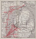
| Date: | 1926 |
|---|---|
| Description: | Pages 21 and 22 from the 1926 schedule are a map showing the routes of the Goodrich Transit Company, Great Lakes Transit Company, Detroit and Cleveland Lin... |
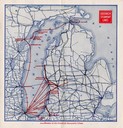
| Date: | 1930 |
|---|---|
| Description: | Page 8 of the 1930 schedule is a map of the routes of the Goodrich Steamship Lines in Lake Michigan and Lake Huron. |
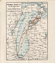
| Date: | 1926 |
|---|---|
| Description: | Map of the routes of the screw-driven passenger/freight vessels of the Michigan Transit Company for 1926. |
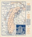
| Date: | 1930 |
|---|---|
| Description: | Map of the routes of the screw passenger and freight vessels of the Michigan Transit Company. Includes a picture of the Park Place hotel in Traverse City, ... |

| Date: | 1910 |
|---|---|
| Description: | Map of Dane County rural delivery in Madison and the town of Westport. |
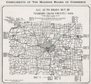
| Date: | 1916 |
|---|---|
| Description: | Map of all automobile roads out of Madison, compliments of the Madison Board Of Commerce. |

| Date: | 1910 |
|---|---|
| Description: | Map of the general plan of the district of the Four Lakes. |
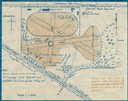
| Date: | 1923 |
|---|---|
| Description: | Map of Oneida County-Rhinelander Airport which was laid out at the county fairgrounds. The map appears on the reverse side of a letter Roy Larson received ... |
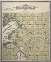
| Date: | 1911 |
|---|---|
| Description: | Plat Map of Blooming Grove in "Atlas of Dane County, Wisconsin." |

| Date: | 1905 |
|---|---|
| Description: | Map of state of Idaho. Department of Interior General Land Office. |
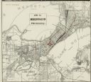
| Date: | 1920 |
|---|---|
| Description: | A map of Madison and the vicinity. Red lines show the street railway. |

| Date: | 1941 |
|---|---|
| Description: | Official highway map of Wisconsin, "the playground of the Midwest," showing the state transportation network prior to World War II. |

| Date: | 1925 |
|---|---|
| Description: | A map of the farm planned by Edwin Bottomley in 1844. |

| Date: | 1925 |
|---|---|
| Description: | Sketch of the first floor plan of the house of Mr. Edwin Bottomley. |

| Date: | 1923 |
|---|---|
| Description: | Vilas County. Published by Chicago, Milwaukee, and St. Paul Ry. |

| Date: | 1904 |
|---|---|
| Description: | A map showing the design for a park fronting on Lake Monona Bay. (Now called Brittingham Park) taken from between pages 44 & 45 of the 1905 Madison Park a... |

| Date: | 1911 |
|---|---|
| Description: | Map of the west part of the city of Madison. |
If you didn't find the material you searched for, our Library Reference Staff can help.
Call our reference desk at 608-264-6535 or email us at: