 Filter: Categories of Wisconsin Historical Images
Filter: COLLECTION_NAME of Map Collection
Filter: Year of 1900-1999
Filter: Year of 1920-1929
Filter: Categories of Wisconsin Historical Images
Filter: COLLECTION_NAME of Map Collection
Filter: Year of 1900-1999
Filter: Year of 1920-1929

| Date: | 1927 |
|---|---|
| Description: | Color map, hand-drawn with comic figures engaged in various activities throughout map. Bordered by the river on the left and Lake Michigan on the right, in... |

| Date: | 1929 |
|---|---|
| Description: | Bird's-eye map of the University of Wisconsin-Madison on Lake Mendota. Black and white drawing with named streets and numbered buildings without location ... |

| Date: | 1920 |
|---|---|
| Description: | A map of Madison and the vicinity. Red lines show the street railway. |

| Date: | 1920 |
|---|---|
| Description: | Map of the Nakoma neighborhood including the proposed golf grounds. |

| Date: | 1923 |
|---|---|
| Description: | Vilas County. Published by Chicago, Milwaukee, and St. Paul Ry. |

| Date: | 1924 |
|---|---|
| Description: | Front and back covers of Scenic Wisconsin Motorways, a guide to Wisconsin roads compiled by Victor F. Pettric and published by the Wisconsin Motorists Asso... |
| Date: | 1922 |
|---|---|
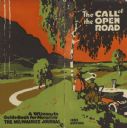
| Description: | Front and back cover of the Call of the Open Road, an annual publication of the Milwaukee Journal Tour Department based on its regular columns of mo... |
| Date: | 1922 |
|---|---|
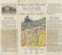
| Description: | Wisconsin Geological and Natural History Survey soil map of Wisconsin supplemented by promotional materials about the County's prospects, schools and agric... |

| Date: | 1926 |
|---|---|
| Description: | This hand-colored blueprint map shows landowners in part of T15N, R5E in Juneau County. North is oriented to the right. |

| Date: | 1926 |
|---|---|
| Description: | A plat map of the village of Verona in Dane County. |
| Date: | 1924 |
|---|---|
| Description: | Map of Verona in Dane County from the Charles Brown Atlas. |

| Date: | 1920 |
|---|---|
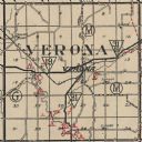
| Description: | Detail of a map of Dane county showing only Verona. |

| Date: | 1925 |
|---|---|
| Description: | This brochure intended for tourists and shows resorts, lakes and railroads in northwestern Wisconsin and part of Michigan’s upper peninsula. Two inset maps... |
| Date: | 1926 |
|---|---|
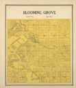
| Description: | Plat map of Blooming Grove Township in Dane County. |

| Date: | 1925 |
|---|---|
| Description: | This map shows state trunk highways, county trunk highways, railroads, canoe trails, lakes, and free public camp sites. The map on the reverse also shows a... |

| Date: | 1928 |
|---|---|
| Description: | This map shows geological formations throughout Wisconsin. Lakes and rivers are labeled, including The Mississippi River, Lake Superior, and Lake Michigan.... |
If you didn't find the material you searched for, our Library Reference Staff can help.
Call our reference desk at 608-264-6535 or email us at:


