 Filter: Categories of Wisconsin Historical Images
Filter: COLLECTION_NAME of Map Collection
Filter: Year of 1900-1999
Filter: Categories of Wisconsin Historical Images
Filter: COLLECTION_NAME of Map Collection
Filter: Year of 1900-1999

| Date: | 1923 |
|---|---|
| Description: | This map shows trails, some in red, for automobiles. The right margin includes a key of markings as well as Minnesota and Wisconsin Highway signs. Communit... |
| Date: | 1905 |
|---|---|
| Description: | A reproduction of the Wisconsin portion of Samuel de Champlain's 1632 map showing the location of the La Nation du Puans, or Ho-Chunk Indians, located next... |

| Date: | 1905 |
|---|---|
| Description: | A reproduction of the Wisconsin portion of Louis Hennepin's 1698 map showing the location of the Ho-Chunk Tribe, the Hurons, the Illinois as well as other ... |
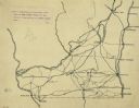
| Date: | 1922 |
|---|---|
| Description: | An ink on tracing paper, hand-drawn of south and eastern Wisconsin, illustrating the roads ranging from Dubuque, Iowa in the east to Green Bay, Wisconsin i... |

| Date: | 1900 |
|---|---|
| Description: | A map of Wisconsin, eastern Minnesota and Iowa, northern Iowa, and Michigan’s Upper Peninsula, showing railway lines, with those marked with heavy red line... |
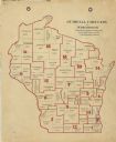
| Date: | 1900 |
|---|---|
| Description: | A map of Wisconsin showing the seventeen judicial circuits of the state. The map also shows the counties of Wisconsin and the total population of each of t... |

| Date: | 1900 |
|---|---|
| Description: | This map, which shows the state of Wisconsin in 1895, was published as Rand, McNally & Co.'s New business atlas map of Wisconsin. Railroads, counties, citi... |

| Date: | 1900 |
|---|---|
| Description: | A map of Wisconsin, eastern Minnesota and Iowa, and Michigan’s Upper Peninsula, showing the rail lines of the Wisconsin Central Railroad are shown in red, ... |

| Date: | 1903 |
|---|---|
| Description: | A map of northern Wisconsin and Michigan showing the names and locations hunting and fishing resorts in the area, as well as location of Chicago and North ... |

| Date: | 1903 |
|---|---|
| Description: | A map that shows the location of each county, city and village in Wisconsin; in addition that maps also identifies railroads their distances between cities... |

| Date: | 1904 |
|---|---|
| Description: | A map that shows the location of the lakes and resorts in northeastern Wisconsin that were reachable by the Chicago and North Western Railway. Shown in the... |

| Date: | 1904 |
|---|---|
| Description: | A business map of Wisconsin also including the western portion of Michigan's Upper Peninsula, eastern Iowa and Minnesota, and northern Illinois, showing, r... |

| Date: | 1905 |
|---|---|
| Description: | A geological survey map of southeastern Wisconsin, showing Pleistocene-era deposits, including drifts, moraines, drumlins and deposits from various glacier... |

| Date: | 1908 |
|---|---|
| Description: | A business map of Wisconsin, showing railroads, counties, cities, villages, rivers, and lakes. Additional areas shown in the map include the western portio... |

| Date: | 1908 |
|---|---|
| Description: | A map of Wisconsin showing cities and towns, rivers, lakes, and railroads. Other areas included in the map are the western portion of Michigan's Upper Pen... |

| Date: | 1909 |
|---|---|
| Description: | A brochure with a map showing the North-Western Railway lines from northern Illinois, starting at Chicago, to southeastern Wisconsin, stopping at Sheboygan... |

| Date: | 1910 |
|---|---|
| Description: | A business map of Wisconsin, showing railroads, counties, cities, villages, rivers, lakes, and electric lines. Additional areas also included in the map ar... |

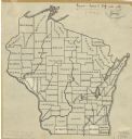
| Date: | 1911 |
|---|---|
| Description: | A pencil on paper, hand-drawn map of Wisconsin, showing the counties of the state. |

| Date: | 1911 |
|---|---|
| Description: | A business atlas map of Wisconsin, showing the railroads, counties, cities, villages, rivers, lakes, electric lines, and steamship lines in the state. Othe... |
| Date: | 1912 |
|---|---|
| Description: | An ink and pencil on paper map of Wisconsin that shows contemporary county divisions in the state. The map depicts the locations of some of the rivers that... |
If you didn't find the material you searched for, our Library Reference Staff can help.
Call our reference desk at 608-264-6535 or email us at: