Filter: Categories of Wisconsin Historical Images
Filter: COLLECTION_NAME of Map Collection
Filter: Year of 1800-1899
Filter: Subject of rivers
Filter: Categories of Wisconsin Historical Images
Filter: COLLECTION_NAME of Map Collection
Filter: Year of 1800-1899
Filter: Subject of rivers
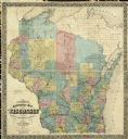
| Date: | 1859 |
|---|---|
| Description: | 1859 sectional map of the state of Wisconsin. |

| Date: | 1878 |
|---|---|
| Description: | Illustrated map of Crawford County. On the bottom right is an inset of a group of people near a train on a railroad track. |

| Date: | 1877 |
|---|---|
| Description: | Map of northern Wisconsin showing the lands owned by Cornell University (shaded portions) in 1877. The map depicts the lakes, river systems, towns, and th... |

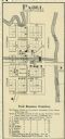
| Date: | 1820 |
|---|---|
| Description: | This map displays the plan for claiming various settlement zones in the Prairie des Chiens area in 1820. It shows Fort Crawford and 87 confirmed and unconf... |
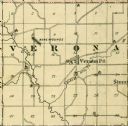
| Date: | 1861 |
|---|---|
| Description: | Portion of a map showing Wisconsin villages including Cambria, Fall River, Columbus, Otsego, and Dekorra. |

| Date: | 1847 |
|---|---|
| Description: | A color map of Kentucky with insets showing Lexington, the Falls of Ohio, and the Ohio River. |

| Date: | 1842 |
|---|---|
| Description: | A map of the Western rivers, a "travellers guide" exhibiting the Mississippi, Missouri, Ohio and Illinois Rivers with principal towns. |
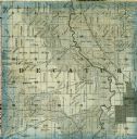
| Date: | 1861 |
|---|---|
| Description: | A detail from a map of Green County, showing only Decatur. |

| Date: | 1883 |
|---|---|
| Description: | Bird's-eye view of Montello, county seat of Marquette County. The granite quarry, woolen mill, and planing mill are clearly identified. A steamboat on Buf... |

| Date: | 1892 |
|---|---|
| Description: | Topographical map of Madison and surrounding communities which include Lake Mendota, Lake Monona, Lake Waubesa and Lake Kegonsa. The red dots on the map sh... |

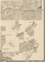
| Date: | 1878 |
|---|---|
| Description: | This map shows block numbers, wards, roads, railroads, parks, and selected buildings and includes a "Milwaukee city street guide" as well as a guide to pub... |

| Date: | 1861 |
|---|---|
| Description: | A general map of Pennsylvania, Virginia, New Jersey and Delaware. Insets include maps of New Orleans, Baltimore, St. Louis, Charleston, Savannah, Washingto... |

| Date: | 1864 |
|---|---|
| Description: | (U.S. 39th Cong. 1stt Sess. Report of Chief engineer) The legend in the upper left corner contains a brief resume of each day's action while the map sho... |

| Date: | 1865 |
|---|---|
| Description: | This map of Maryland and Virginia shows railroads, rivers, cities and towns, and the positions of Confederate troops and defenses in Virginia in 1861. |

| Date: | 1861 |
|---|---|
| Description: | This map was reproduced photographically and issued in Augusta, Ga., in the early days of the Civil War. It includes panels showing Virginia, Maryland, the... |

| Date: | 1861 |
|---|---|
| Description: | Shows townships and sections, landowners, and woodlands. Includes inset maps of Monroe, Brodhead, Albany, Cadiz, Decatur, Dayton, Clarence, Springfield, Tw... |
If you didn't find the material you searched for, our Library Reference Staff can help.
Call our reference desk at 608-264-6535 or email us at: