 Filter: Categories of Wisconsin Historical Images
Filter: COLLECTION_NAME of Map Collection
Filter: Subject of water
Filter: Year of 1900-1999
Filter: Categories of Wisconsin Historical Images
Filter: COLLECTION_NAME of Map Collection
Filter: Subject of water
Filter: Year of 1900-1999

| Date: | 1910 |
|---|---|
| Description: | This is a 5 part map showing automobile roads, common roads, cross roads, and railroads. Each map includes a diagram on reverse side and automobile trips o... |

| Date: | 1910 |
|---|---|
| Description: | This map shows railroads, counties, cities and villages, rivers, lakes, and electric lines are shown in Wisconsin, the western portion of Michigan's Upper ... |

| Date: | 1911 |
|---|---|
| Description: | This map of Wisconsin, the western portion of Michigan's Upper Peninsula, and northern Illinois shows counties, towns, cities and villages, rivers and lake... |

| Date: | 1912 |
|---|---|
| Description: | This map shows the area around Fort McCoy, labeled "U.S. Military Reservation," and Camp Douglas in the Sparta-Tomah region. Road, railroads, towns, cities... |

| Date: | 1912 |
|---|---|
| Description: | This map from the U.S. General Land Office shows railroads, counties, cities and villages, rivers, lakes, U.S. Land Offices, Indian reservations, military ... |

| Date: | 1912 |
|---|---|
| Description: | This map is pen, ink, and pencil on tracing paper. The map was traced from U.S. Geological Survey map of Wisconsin, compiled in 1910-1911, and printed in 1... |
| Date: | 1912 |
|---|---|
| Description: | This map is pen and ink on paper. The map was traced from a more detailed population dot map, this map shows only the major towns and cities in southern Wi... |

| Date: | 1904 |
|---|---|
| Description: | A brochure for the lake region of north-eastern Illinois and south-eastern Wisconsin providing information on summer activities and places to stay in the a... |
| Date: | 1905 |
|---|---|
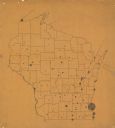
| Description: | A map of showing the population density of foreign-born Scandinavians in Wisconsin based information from the 1905 census. The map also shows the county bo... |

| Date: | 1906 |
|---|---|
| Description: | A hand-colored map of Wisconsin identifying the railroads, counties, cities, rivers, and lakes in Wisconsin, eastern Minnesota and Iowa, northern Illinois,... |

| Date: | 1906 |
|---|---|
| Description: | A hand-colored commercial map of Wisconsin and portions of eastern Minnesota, Iowa, northern Illinois, and the Michigan’s Upper Peninsula. The map shows ra... |

| Date: | 1906 |
|---|---|
| Description: | A commercial map of Wisconsin showing the location of creameries and cheese factories in the state. In the lower portion of the map provides the number of ... |
| Date: | 1907 |
|---|---|
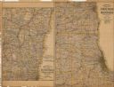
| Description: | The first map shows the area from Milwaukee north to Green Bay and west to Columbus; the second map displays the area between Chicago and Milwaukee and wes... |
| Date: | 1927 |
|---|---|
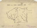
| Description: | A hand-drawn map outlining the counties of Grant and Iowa counties as they would have appeared in 1837. |
| Date: | 1908 |
|---|---|
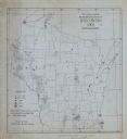
| Description: | This map shows townships and sections, landownership, schools, and churches. Includes text explaining survey system. |

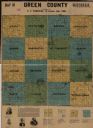
| Date: | 1926 |
|---|---|
| Description: | A topographic map of Green County, showing by contours and spot heights the topographic and natural features of the county. The contour intervals are 20 fe... |

| Date: | 1968 |
|---|---|
| Description: | A topographic map of east central Wisconsin, that covers an area stretching from Green Bay on the east to Edgar and Vesper on the west, Wausau on the north... |

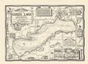
| Date: | 1937 |
|---|---|
| Description: | A pictorial, hydrographic map shows sailing courses, historical and contemporary coastal attractions, roads, and the contour depths of Green Lake, Wisconsi... |
| Date: | 1970 |
|---|---|
| Description: | A pictorial map shows roads, parks, points of interest, keys to the property owners' association directory, and the contour depths of Green Lake, Wisconsin... |
If you didn't find the material you searched for, our Library Reference Staff can help.
Call our reference desk at 608-264-6535 or email us at:
