| Date: | 1859 |
|---|---|
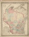
| Description: | This 1859 railroad map shows counties, cities, rivers and lakes in the entire state of Wisconsin. It includes an inset depicting the railroads in Milwaukee... |

| Date: | 1916 |
|---|---|
| Description: | Southeastern Wisconsin which lies east of Whitewater and south of Port Washington. |

| Date: | |
|---|---|
| Description: | Plan of township no. 3 north, range no. 5 west of the 4th principal meridian. |

| Date: | 1780 |
|---|---|
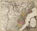
| Description: | Contenant: New Hampshire, Massachusetsbaye, Rhode Island, Connecticut, La Nouvelle York, Nouvelle Jersey, La Pensilvanie, Les Comtes de Newcastle, Kent et ... |

| Date: | 1913 |
|---|---|
| Description: | Shows lands in green owned and for sale by Homeseekers Land Company, H.J. McKusick, Secretary. Map, part colored. No scale. Photographs on reverse of origi... |

| Date: | 1798 |
|---|---|
| Description: | Uncolored. No scale. One of the earliest maps to show the proposed division of the northwest territory into states. |

| Date: | 1908 |
|---|---|
| Description: | Colored map in perspective indicates railroad routes. Lake Winnebago and Oshkosh in center, area extends to Shawano (top right corner), Green Bay (bottom r... |

| Date: | 1913 |
|---|---|
| Description: | Wisconsin map showing fifteen hundred miles of national highways proposed by the National Highways Association. Scale: 1:2,500,000. These highways will dir... |

| Date: | 1862 |
|---|---|
| Description: | Lithography of C. Van Benthuysen. |

| Date: | 1755 |
|---|---|
| Description: | From "A map of the British and French dominions in North American with the roads, distances, limits, and extent of the settlements". |

| Date: | 1733 |
|---|---|
| Description: | From "A map of the British Empire in America with the French and Spanish settlements adjacent thereto". This is the Wisconsin and Minnesota section. |

| Date: | 1839 |
|---|---|
| Description: | Shows locations of cities, towns, villages, post hamlets, canals, rail and stage roads. Includes table of steamboat routes and distances; vignette of "Maid... |

| Date: | 1853 |
|---|---|
| Description: | Shows railroads, planned and in place. |

| Date: | 1887 |
|---|---|
| Description: | Benedict & Co. engineers. As shown by development to March 1st 1887. Inset: Map of northern Wisconsin showing location of range. Lands in red. |

| Date: | 1853 |
|---|---|
| Description: | Plan no. 3. Scale 2000 feet to one inch. |

| Date: | 1824 |
|---|---|
| Description: | Drawn and engraved by Sidney Hall. Published by Longman, Hurst, Rees, Orme, Brown & Green. Scale: 1:200. Partly colored. This is probably the second Europe... |

| Date: | 1872 |
|---|---|
| Description: | Map of the Chippewa River, from the head of navigation at the city of Chippewa Falls, covering a distance of 16 miles above : showing the established impro... |

| Date: | 1852 |
|---|---|
| Description: | Map reads: "The State of Wisconsin- compiled from the latest authorities". In addition, there is a scale which is six miles for every inch, and a profile o... |

| Date: | |
|---|---|
| Description: | Map reads: "The United States from the Latest Authorities". View of the states and territories. |

| Date: | 1855 |
|---|---|
| Description: | Map reads "Our Country" which is accompanied by a sailor with a flag to the left and workers rejoicing under the Constitution and Laws to the right. Across... |
If you didn't find the material you searched for, our Library Reference Staff can help.
Call our reference desk at 608-264-6535 or email us at: