 Search: wisconsin
Filter: Type of Photograph
Filter: Subject of dwellings
Filter: Subject of aerial photographs
Search: wisconsin
Filter: Type of Photograph
Filter: Subject of dwellings
Filter: Subject of aerial photographs

| Date: | 1922 |
|---|---|
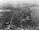
| Description: | Aerial view of the Wisconsin State Capitol and Lake Monona. |
| Date: | 1946 |
|---|---|
| Description: | Aerial view of the University of Wisconsin campus with Lake Mendota on the right. |

| Date: | 08 20 1930 |
|---|---|
| Description: | Aerial view of the Madison skyline from University of Wisconsin Field House, overlooking the Wisconsin State Capitol and, in the foreground, Gateway Lumber... |
| Date: | 1957 |
|---|---|
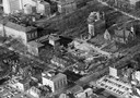
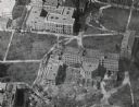
| Description: | Aerial view of the construction of Chadbourne Hall, lower Bascom Hill on the University of Wisconsin campus. |

| Date: | 07 24 1952 |
|---|---|
| Description: | Aerial view of the Wisconsin State Fair grounds, showing the GMC trucks tent and the residential neighborhood that bordered the grounds. |

| Date: | 1928 |
|---|---|
| Description: | University of Wisconsin-Madison, looking west. Lake Mendota and Picnic Point are in the upper right of the image. Bascom Hall, the Red Gym, the Wisconsin H... |

| Date: | 1945 |
|---|---|
| Description: | View of the lower campus of the University of Wisconsin-Madison includes Bascom Hill, Wisconsin Historical Society, Memorial Union and the Armory (Red Gym ... |

| Date: | 1908 |
|---|---|
| Description: | Aerial View of University of Wisconsin-Madison College of Agriculture. Lake Mendota with Picnic Point is in the background. |

| Date: | 1900 |
|---|---|
| Description: | Aerial View of University of Wisconsin-Madison College of Agriculture. Lake Mendota with Picnic Point is in the background. |
| Date: | 03 28 1949 |
|---|---|
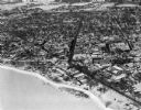
| Description: | Aerial photographs of Boscobel, Wisconsin. |
| Date: | |
|---|---|
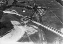
| Description: | Aerial view of Dell View Hotel and Lake Delton airport. |

| Date: | 1947 |
|---|---|
| Description: | University of Wisconsin-Madison, from Park Street to the men's dormitories. Part of Lake Mendota is in the top right corner. |
| Date: | 02 09 1949 |
|---|---|
| Description: | One of five aerial views of Portage, including the frozen Wisconsin River. |
| Date: | 1956 |
|---|---|
| Description: | Aerial view of Birge and Bascom Halls (formerly Main Hall) on the University of Wisconsin-Madison campus. Birge Hall (foreground) with addition under cons... |

| Date: | 1910 |
|---|---|
| Description: | Aerial View of University of Wisconsin-Madison College of Agriculture. Lake Mendota with Picnic Point is in the background. |

| Date: | 1946 |
|---|---|
| Description: | University of Wisconsin-Madison buildings. The General Hospital is in the center, surrounded by homes, trees, and other university buildings. |
| Date: | 1924 |
|---|---|
| Description: | University of Wisconsin-Madison lower campus and the surrounding neighborhoods. Lake Mendota and Picnic Point are in the background. |

| Date: | 09 1996 |
|---|---|
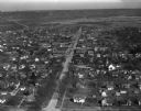
| Description: | "Theresa's Bonduel & Wisconsin Streets from the air." |

| Date: | 1908 |
|---|---|
| Description: | Aerial view of Camp Randall Field on the University of Wisconsin-Madison campus. University Heights is in the background. |

| Date: | 1956 |
|---|---|
| Description: | Aerial view over University Avenue of the University of Wisconsin-Madison campus, including University farm in the upper middle. The shoreline of Lake Mend... |
If you didn't find the material you searched for, our Library Reference Staff can help.
Call our reference desk at 608-264-6535 or email us at: