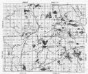
| Date: | 1900 |
|---|---|
| Description: | This map shows logging roads, railroads with spur lines, trails, rapids, lumber camps, Indian villages, summer resort, lakes, rivers, and ponds. |

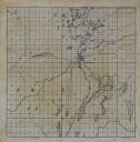
| Date: | 1920 |
|---|---|
| Description: | This manuscript map of southern Bayfield County, Wisconsin, covers the towns of Cable and Drummond and portions of Grandview and Namekagon. Shown are the t... |

| Date: | 1974 |
|---|---|
| Description: | This map shows streets, businesses and parks. The Yellow River is labeled. The Plat shows saw mills and land owned by D.R.W. Williams, Wm. Williams, and Jo... |
If you didn't find the material you searched for, our Library Reference Staff can help.
Call our reference desk at 608-264-6535 or email us at: