| Date: | 1688 |
|---|---|
| Description: | This map includes vignettes of Amerindian life with text describing geography, culture, and exploration activity, written in French. The Great Lakes, river... |

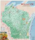
| Date: | 1996 |
|---|---|
| Description: | This map shows roads, lakes, points of interest including colleges, trails, historic communities and sites, museums, and parks. Also included are descripti... |

| Date: | 11 14 1942 |
|---|---|
| Description: | This pictorial map illustrates Potawatomi Indian legends from the region of Lower Phantom Lake, labeled Howitt Lake on the map, Phantom Lake, and Mukwonag... |
If you didn't find the material you searched for, our Library Reference Staff can help.
Call our reference desk at 608-264-6535 or email us at: