| Date: | 1740 |
|---|---|
| Description: | Engraved and hand-colored map of the Iberian peninsula as a theater of war during the War of the Spanish Succession (1701-1714). The map is dedicated to Ki... |

| Date: | 1755 |
|---|---|
| Description: | This map shows the eastern half of North America during the French and Indian war, including cities, borders, Native American Land, forts, and detailed geo... |

| Date: | 1766 |
|---|---|
| Description: | This map of North America shows the boundaries of European claims at the end of the French and Indian war. The British colonies extend to the Mississippi. ... |

| Date: | 1760 |
|---|---|
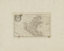
| Description: | Map of North America based upon the cartographic work of de L'Isle. It shows cities, regions, lakes, rivers, Native American land, mountains, islands, and ... |
If you didn't find the material you searched for, our Library Reference Staff can help.
Call our reference desk at 608-264-6535 or email us at: