| Date: | 1864 |
|---|---|
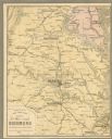
| Description: | This colored map shows cities, rail lines, and geographic features in eastern Virginia. Circles around Richmond at 10 mile intervals indicate distances fro... |

| Date: | 1864 |
|---|---|
| Description: | Map of eastern Virginia and part of Maryland, showing engagements by crossed swords, fortifications surrounding Richmond, routes of the opposing armies fro... |
If you didn't find the material you searched for, our Library Reference Staff can help.
Call our reference desk at 608-264-6535 or email us at: