Filter: Year of 1700-1799
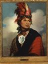
| Date: | 1786 |
|---|---|
| Description: | Print of a Gilbert Stuart painted portrait of Thayendangea (known also as Joseph Brant). He wears a feathered headdress and a shell around his neck. |
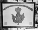
| Date: | 1719 |
|---|---|
| Description: | Photograph of a framed Scottish Historical Armorial Flag. |

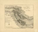
| Date: | 1712 |
|---|---|
| Description: | This drawing, based on an 1897 survey, appeared in the 1899 Proceedings of the State Historical Society of Wisconsin, accompanying Publius V. Lawson's arti... |
| Date: | 07 13 1778 |
|---|---|
| Description: | A brief letter written by Daniel Boone to "Dear Col." |
| Date: | 08 11 1774 |
|---|---|
| Description: | A letter from James Robertson to Col. William Preston. From Preston and Virginia Papers [Calendar series Volume 1]: "Culbertson's. Letter to Col. Wi... |

| Date: | 10 12 1774 |
|---|---|
| Description: | A repaired letter written by Maj. Arthur Campbell to William Preston. From Preston and Virginia Papers [Calendar series Volume 1]: "Royal Oak. Lette... |

| Date: | 10 12 1774 |
|---|---|
| Description: | The back page of a repaired letter from Maj. Arthur Campbell to William Preston. From Preston and Virginia Papers [Calendar series Volume 1]: "Royal... |

| Date: | 09 19 1787 |
|---|---|
| Description: | The first printing of the United States Constitution found in the "Pennsylvania Packet," and "Daily Advertiser." |

| Date: | 09 19 1787 |
|---|---|
| Description: | The first printing of the United States Constitution found in the "Pennsylvania Packet," and "Daily Advertiser." |

| Date: | 1774 |
|---|---|
| Description: | A hand-drawn plat map of Elkcorn (Elkhorn?) Creek. |
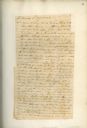
| Date: | 02 24 1779 |
|---|---|
| Description: | A letter from Governor Henry Hamilton to Colonel Clark proposing a truce. |

| Date: | 1720 |
|---|---|
| Description: | Double hemispherical world map showing routes of Tasman, Magellan, Mendana, etc. Relief shown pictorially. Title in oak wreath cartouche. Map between four ... |

| Date: | 1740 |
|---|---|
| Description: | From Weigel's Atlas portatilis, oder, Compendieuse Vorstellung der gantzen Welt. Map of Europe. |

| Date: | 1712 |
|---|---|
| Description: | Engraved double-hemispherical world map by Moll, included in his atlas The world described, or, A new and correct sett of maps: shewing the kingdoms and st... |

| Date: | 1798 |
|---|---|
| Description: | Engraved and hand-colored map of Egypt. Map title appears on bottom left as a carving in stone next ... |

| Date: | 1740 |
|---|---|
| Description: | Engraved and hand-colored map of the Iberian peninsula as a theater of war during the War of the Spanish Succession (1701-1714). The map is dedicated to Ki... |

| Date: | 1785 |
|---|---|
| Description: | Map of part of North America engraved and hand-colored (the light brown design is a superposition of the map and cartouche derived from the oxidation of th... |

| Date: | 02 01 1793 |
|---|---|
| Description: | Text in the upper right corner reads, "A Map of The Western Part of the Territories belonging to the United States of America. Drawn from the best authorit... |

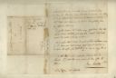
| Date: | 06 19 1775 |
|---|---|
| Description: | The front page of a letter written to Col. William Preston from Thomas Lewis. From Preston and Virginia Papers [Calendar series Volume 1]: "Letter t... |
If you didn't find the material you searched for, our Library Reference Staff can help.
Call our reference desk at 608-264-6535 or email us at: