| Date: | 01 01 1852 |
|---|---|
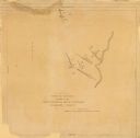
| Description: | These manuscript maps, drawn by William H. Canfield in 1852, illustrate mounds primarily in Sauk County, Wisconsin, in the towns of Greenfield, La Valle, M... |

| Date: | 1915 |
|---|---|
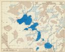
| Description: | This 1915 map covers portions of Barron, Chippewa, and Rusk counties in Wisconsin. Shown are the township and range grid, sections, cities and villages, ra... |

| Date: | 1941 |
|---|---|
| Description: | This pictorial map shows sites related to Indian legends, mounds, and trails in the Chain O' Lakes region in southwestern Waupaca County, Wisconsin. |

| Date: | 1974 |
|---|---|
| Description: | This 1974 map is a reproduction of the original survey maps of the Four Lakes region of Dane County, Wisconsin. It shows sections, lakes, rivers, wetlands,... |

| Date: | 1970 |
|---|---|
| Description: | This pictorial map of Dunn County, Wisconsin, from the 1970s depicts historical events that occurred in the county. It shows cemeteries, churches, schools,... |

| Date: | 1864 |
|---|---|
| Description: | This map is pen and watercolor on paper and shows profile and geological formation of Blue Mound and location of Arnold’s Hotel and Brigham Lead Mines. |

| Date: | 1850 |
|---|---|
| Description: | This 1850 survey by William H. Canfield shows the mounds near Wiegands Bay on the Wisconsin River in the Town of Merrimac, Sauk County, Wisconsin. |

| Date: | 1859 |
|---|---|
| Description: | Shows townships and sections, landownership, roads, railroads, rural residences, schools, churches, and topography. Relief shown by hachures. "From governm... |

| Date: | 1913 |
|---|---|
| Description: | Ink and watercolor on tracing cloth. Shows parts of Green Lake, Princeton, and Brooklyn townships, Indian mound groups, Green Lake, and other significant b... |

| Wisconsin Historical Museum Object – Feature Story |
|---|
| Cast iron Wisconsin effigy mound model in the shape of a "trunk and arms of a man", designed by Increase A. Lapham, c. 1875. (Museum object #1975.8.12) |

| Wisconsin Historical Museum Object – Feature Story |
|---|
| Human figurine fragment made of non-tempered, smoothed clay, c. 100 - 200 A.D., found at Pine River site, Richland County, WI (Museum object #2004.5.1) |

| The History of Paleo-Indians in Wisconsin |
|---|
| Learn about the Paleo-Indians who first inhabited the Wisconsin territory and the archaeological excavations that have revealed their culture. |

| The Genesis of Modern Wisconsin |
|---|
| Discovery the history of the Woodland and Middle Mississippean Indian cultures and their relationship to modern Wisconsin. |

| Date: | 1850 |
|---|---|
| Description: | Map showing Indian mounds and graves as well as ground cover types at Township 8, Range 22. There is an inset diagram of an effigy mound labeled "The Cross... |

| Date: | |
|---|---|
| Description: | Map showing Indian mounds in Milwaukee's Second Ward from a sketch made by Increase Lapham in 1836. Streets shown on the map include 6th Street, 5th Street... |

| Date: | 1800 |
|---|---|
| Description: | An ink on paper map for a plan of mounds in Milwaukee county. The map is situated pointing north. |

| Date: | |
|---|---|
| Description: | Photographic postcard view of one of the Indian mounds at Aztalan State Park. Steps lead up to the top of the mound from the right, and a tall fence is beh... |

| Date: | |
|---|---|
| Description: | Photographic postcard view of three views from Aztalan State Park; Indian Mound at sunset, pottery, and a fence. |

| Date: | 1800 |
|---|---|
| Description: | This map on two sheets shows a group of ancient mounds near the southeast corner of the city of Beloit and a group of ancient mounds north of Rockton Stati... |

| Date: | 1873 |
|---|---|
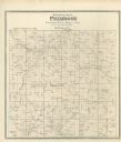
| Description: | A map of the township of Primrose from the "Atlas of Dane County." |
If you didn't find the material you searched for, our Library Reference Staff can help.
Call our reference desk at 608-264-6535 or email us at: