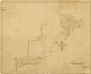
| Date: | 1835 |
|---|---|
| Description: | Ink on tracing paper map of Green Bay, Wisconsin and nearby areas, Lake Winnebago, Fox and Wolf Rivers, and the junctions of the Mississippi and Wisconsin ... |

| Date: | 1868 |
|---|---|
| Description: | Map showing the northern water routes between Mississippi River and Atlantic Ocean Relief shown by hachures. Includes Profile of the Erie Canal, table of ... |

| Brief history of the Fox and Wisconsin River Improvement Company. |

| A Bizarre Story of Land Prospecting Gone Awry |
|---|
| Read the amazing story of a man who watched his potential 10,000-square-mile northern Wisconsin empire disappear into thin air. |

| Steamships, Canals and the 19th Century Economy |
|---|
| Discover what happened when 19th century Wisconsin settlers tried to construct a canal between the Mississippi and the Great Lakes. |
If you didn't find the material you searched for, our Library Reference Staff can help.
Call our reference desk at 608-264-6535 or email us at: