 Filter: FORMAT_TYPE of drawings
Filter: Year of 1900-1999
Filter: Type of Map or Atlas
Filter: FORMAT_TYPE of drawings
Filter: Year of 1900-1999
Filter: Type of Map or Atlas

| Date: | 1936 |
|---|---|
| Description: | This map is red and black ink on tracing cloth and is oriented with north to the upper left. This hand-drawn map shows a central portion of the military ro... |

| Date: | 06 28 1958 |
|---|---|
| Description: | Official plat map drawn in ink and watercolor, T. 15 N, R. 11 E. |

| Date: | 1941 |
|---|---|
| Description: | Hand-drawn, watercolor and ink, map of Lake Mendota. Locations and many small figures appear around the shore with explanations referring to Indian legends... |

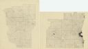
| Date: | 1906 |
|---|---|
| Description: | Hand-drawn topographical map of the Turville Estate. |

| Date: | 1906 |
|---|---|
| Description: | Topographical map of Turville Point and lands to the South to Nine Springs Creek. |
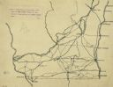
| Date: | 1922 |
|---|---|
| Description: | An ink on tracing paper, hand-drawn of south and eastern Wisconsin, illustrating the roads ranging from Dubuque, Iowa in the east to Green Bay, Wisconsin i... |

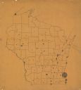
| Date: | 1911 |
|---|---|
| Description: | A pencil on paper, hand-drawn map of Wisconsin, showing the counties of the state. |
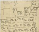
| Date: | 1925 |
|---|---|
| Description: | A pen, ink and pencil on paper, hand-drawn map of southern Wisconsin that shows the area’s 1920 population density through the use of dots, dividing the co... |
| Date: | 1922 |
|---|---|
| Description: | A hand-sketched map representing 1850 data of southern and eastern Wisconsin displaying the demographical breakouts for the counties in those areas, showin... |

| Date: | 1916 |
|---|---|
| Description: | A pen on paper, hand-drawn map that shows the railroads, rivers, county outlines, and cities and villages in Wisconsin, northern Illinois, and the western ... |

| Date: | 1912 |
|---|---|
| Description: | This map is pen, ink, and pencil on tracing paper. The map was traced from U.S. Geological Survey map of Wisconsin, compiled in 1910-1911, and printed in 1... |
| Date: | 1912 |
|---|---|
| Description: | This map is pen and ink on paper. The map was traced from a more detailed population dot map, this map shows only the major towns and cities in southern Wi... |
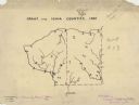
| Date: | 1927 |
|---|---|
| Description: | A hand-drawn map outlining the counties of Grant and Iowa counties as they would have appeared in 1837. |

| Date: | 1947 |
|---|---|
| Description: | An ink on paper, hand-drawn map of Jefferson County, Wisconsin, that identifies named hills, other points of interest, and the Lake Mills moraine system in... |

| Date: | 12 25 1942 |
|---|---|
| Description: | This hand-drawn map shows the highways and features in the Rock Lake-Lake Mills area in the towns of Aztalan and Lake Mills, Jefferson County, Wisconsin. T... |

| Date: | 1920 |
|---|---|
| Description: | An ink on tracing paper, hand-drawn map that shows lead mines, the boundary of the lead bearing strata, and the military road in Lafayette, Grant, Iowa, an... |

| Date: | 1930 |
|---|---|
| Description: | This manuscript map, likely drawn in the 1930s, shows Fox Lake, in Dodge County, Wisconsin, and the roads and resorts in the vicinity. |

| Date: | 1972 |
|---|---|
| Description: | Ink on tracing paper. This map shows rivers, Prairie du Chien, site of Fort Crawford, Excelsior, Fort Andrew, Boscobel, Blue River, Orion, Muscoda, Castle ... |

| Date: | 1913 |
|---|---|
| Description: | Ink and watercolor on tracing cloth. Shows parts of Green Lake, Princeton, and Brooklyn townships, Indian mound groups, Green Lake, and other significant b... |

| Date: | 1900 |
|---|---|
| Description: | Pen and pencil on tracing paper. Shows landownership by name, local streets, local businesses, mill pond, creek, and proposed railroad. |
If you didn't find the material you searched for, our Library Reference Staff can help.
Call our reference desk at 608-264-6535 or email us at: