 Filter: Community of West Point

| Date: | 1965 |
|---|---|
| Description: | A man stands in a kitchen, while a woman on the far right of the frame looks on. The building is a Freedom House used by civil rights volunteers. |

| Date: | 1965 |
|---|---|
| Description: | Two men and a woman stand outside the entrance to the Clay County Courthouse. To the right of the doorway is a sign that reads "Fallout Shelter." The capti... |
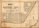
| Date: | 1836 |
|---|---|
| Description: | This map shows proposed lot and block numbers for a paper city located in township 10 north, range 7 east, Wisconsin Territory, now the Town of West Point,... |

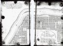
| Date: | |
|---|---|
| Description: | This plat map shows lots and block numbers of a paper city located on the Wisconsin River and Hasting’s Creek, in what is now the Town of West Point, Colum... |
| Date: | 1900 |
|---|---|
| Description: | This map shows lots, public squares, landing, streets, and promenade of a paper city on a site now in the Town of West Point, Columbia County. The Wisconsi... |

| Date: | 1940 |
|---|---|
| Description: | A view from the top of Gibraltar Rock showing a portion of the bluff, left, and rolling fields and woodlands beyond. There is a pond or stream on the right... |

| Community: | West Point |
|---|---|
| County: | Columbia |
| Historic Name: | MERRIMAC FERRY |
| Reference Number: | 3316 |
| Community: | West Point |
|---|---|
| County: | Columbia |
| Historic Name: | |
| Reference Number: | 3345 |
| Community: | West Point |
|---|---|
| County: | Columbia |
| Historic Name: | |
| Reference Number: | 3346 |
| Community: | West Point |
|---|---|
| County: | Columbia |
| Historic Name: | |
| Reference Number: | 3347 |

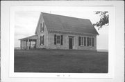
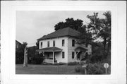
| Community: | West Point |
|---|---|
| County: | Columbia |
| Historic Name: | A. H. Lennartz House |
| Reference Number: | 3348 |
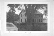
| Community: | West Point |
|---|---|
| County: | Columbia |
| Historic Name: | |
| Reference Number: | 3349 |

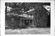
| Community: | West Point |
|---|---|
| County: | Columbia |
| Historic Name: | |
| Reference Number: | 62851 |

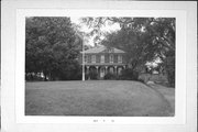
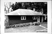
| Community: | West Point |
|---|---|
| County: | Columbia |
| Historic Name: | GEORGE PRIDEAUX COTTAGE |
| Reference Number: | 62853 |

| Community: | West Point |
|---|---|
| County: | Columbia |
| Historic Name: | O.E. NOBLE COTTAGE |
| Reference Number: | 62855 |
| Community: | West Point |
|---|---|
| County: | Columbia |
| Historic Name: | |
| Reference Number: | 62868 |

| Community: | West Point |
|---|---|
| County: | Columbia |
| Historic Name: | |
| Reference Number: | 62870 |
| Community: | West Point |
|---|---|
| County: | Columbia |
| Historic Name: | |
| Reference Number: | 62872 |

| Community: | West Point |
|---|---|
| County: | Columbia |
| Historic Name: | |
| Reference Number: | 62878 |

| Community: | West Point |
|---|---|
| County: | Columbia |
| Historic Name: | |
| Reference Number: | 62880 |
If you didn't find the material you searched for, our Library Reference Staff can help.
Call our reference desk at 608-264-6535 or email us at: