 Filter: Community of Iron Ridge

| Date: | 1921 |
|---|---|
| Description: | Relief shown by contours and spot heights. Includes inset location map. "Contour interval 10 feet." "Advance sheet, subject to correction." "Surveyed in 19... |

| Date: | 1868 |
|---|---|
| Description: | This map is ink on tracing cloth and shows lot and block numbers, depot, railroads and side tracks, and streets in sections 24 and 25, T.11, R.16E. The map... |

| Date: | 1870 |
|---|---|
| Description: | This map is ink and color on tracing cloth and shows Iron Ridge, the hotel and saw mill at Iron Ridge Village, Milwaukee & St. Paul Railway, plank road, an... |

| Date: | |
|---|---|
| Description: | Slightly elevated view of a canning factory, with workers lined up out front, and a man standing in a wagon pulled by a team of horses. Railroad tracks are... |

| Community: | Iron Ridge |
|---|---|
| County: | Dodge |
| Historic Name: | COMMERCIAL STATE BANK |
| Reference Number: | 15215 |

| Community: | Iron Ridge |
|---|---|
| County: | Dodge |
| Historic Name: | |
| Reference Number: | 15216 |

| Community: | Iron Ridge |
|---|---|
| County: | Dodge |
| Historic Name: | |
| Reference Number: | 15217 |
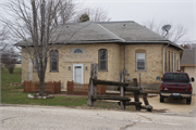
| Community: | Iron Ridge |
|---|---|
| County: | Dodge |
| Historic Name: | Maple Grove School |
| Reference Number: | 224389 |

| Community: | Iron Ridge |
|---|---|
| County: | Dodge |
| Historic Name: | |
| Reference Number: | 224390 |

| Community: | Iron Ridge |
|---|---|
| County: | Dodge |
| Historic Name: | |
| Reference Number: | 224391 |
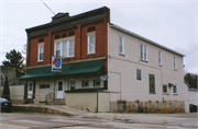
| Community: | Iron Ridge |
|---|---|
| County: | Dodge |
| Historic Name: | H. Bilgrien Building |
| Reference Number: | 93593 |
If you didn't find the material you searched for, our Library Reference Staff can help.
Call our reference desk at 608-264-6535 or email us at: