| Date: | 1910 |
|---|---|
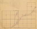
| Description: | This map is ink on paper. Shows Bruce’s proposed railway route and Moon’s railroad survey route along the Flambeau River, in parts of Lake and Eisenstein t... |

| Community: | Eisenstein |
|---|---|
| County: | Price |
| Historic Name: | |
| Reference Number: | 19092 |

| Community: | Eisenstein |
|---|---|
| County: | Price |
| Historic Name: | |
| Reference Number: | 19093 |
If you didn't find the material you searched for, our Library Reference Staff can help.
Call our reference desk at 608-264-6535 or email us at: