 Filter: Categories of Wisconsin Historical Images
Filter: GENRE of Map or Atlas
Filter: Year of 1900-1999
Filter: Categories of Wisconsin Historical Images
Filter: GENRE of Map or Atlas
Filter: Year of 1900-1999

| Date: | 1920 |
|---|---|
| Description: | A map of Madison and the vicinity. Red lines show the street railway. |

| Date: | 1904 |
|---|---|
| Description: | This map shows a plat of the east part of the city, numbered blocks and lots, some landownership, local streets, roads, railroads, wards by number, parks, ... |

| Date: | 1920 |
|---|---|
| Description: | Map of the Nakoma neighborhood including the proposed golf grounds. |

| Date: | 1941 |
|---|---|
| Description: | Official highway map of Wisconsin, "the playground of the Midwest," showing the state transportation network prior to World War II. |

| Date: | 1904 |
|---|---|
| Description: | This map shows a plat of the west part of the city, numbered blocks and lots, some landownership, local streets, roads, railroads, wards by number, parks, ... |
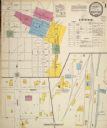
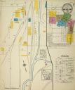
| Date: | 1900 |
|---|---|
| Description: | Sanborn map of Mineral Point, sheet 1. |
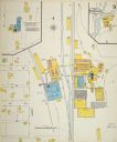
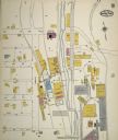
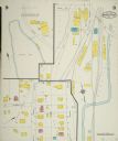
| Date: | 1900 |
|---|---|
| Description: | Sanborn map, sheet 5, of a portion of Mineral Point. |
| Date: | 08 1908 |
|---|---|
| Description: | Sanborn map of a portion of Mineral Point. |
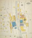
| Date: | 1908 |
|---|---|
| Description: | Sanborn map, sheet 7, of a portion of Mineral Point. |
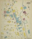
| Date: | 09 1915 |
|---|---|
| Description: | Sheet 1 of a Sanborn map of a portion of Mineral Point. |
| Date: | 09 1915 |
|---|---|
| Description: | Sheet 8 of a Sanborn map of a portion of Mineral Point. |
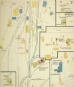
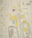
| Date: | 09 1915 |
|---|---|
| Description: | Sheet 7 of a Sanborn map of a portion of Mineral Point. |
| Date: | 07 1929 |
|---|---|
| Description: | Sheet 10 of a Sanborn map of a portion of Mineral Point. |
| Date: | 07 1929 |
|---|---|
| Description: | Sheet 9 of a Sanborn map of a portion of Mineral Point. |

| Date: | 1925 |
|---|---|
| Description: | A map of the farm planned by Edwin Bottomley in 1844. |

| Date: | 1925 |
|---|---|
| Description: | Sketch of the first floor plan of the house of Mr. Edwin Bottomley. |

| Date: | 1923 |
|---|---|
| Description: | Vilas County. Published by Chicago, Milwaukee, and St. Paul Ry. |

| Date: | 1909 |
|---|---|
| Description: | [Lithography] by Poole Bros. Contains descriptive information. Short jaunts for busy people to nearby resorts in Illinois and Wisconsin. |

| Date: | 1918 |
|---|---|
| Description: | Map illlustrates creameries, condenseries and cheese factories in Wisconsin, January, 1918, and value of products. Five smaller maps in margin show changes... |
If you didn't find the material you searched for, our Library Reference Staff can help.
Call our reference desk at 608-264-6535 or email us at:
