
| Date: | 11 26 1907 |
|---|---|
| Description: | Relief shown by hachures. Shows roads, railroads, schools, post offices, rivers, and lakes of Douglas County, and portions of Minnesota and Lake Superior. ... |
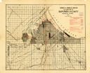
| Date: | 1907 |
|---|---|
| Description: | This map of Superior and the vicinity shows selected company properties, railroads, and roads in a portion of Douglas County. The map reads: "Copyrighted 1... |
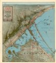
| Date: | 1909 |
|---|---|
| Description: | This map of Duluth and Superior was issued by the Duluth Street Railway Company and shows street railway routes in the cities, as well as lakes, bays, harb... |
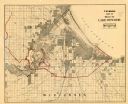
| Date: | 1909 |
|---|---|
| Description: | This map shows Duluth, Minnesota and Superior, Wisconsin, and portions of Saint Louis County, Minnesota and Douglas County, Wisconsin. Water depth is shown... |
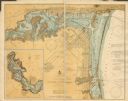
| Date: | 1901 |
|---|---|
| Description: | This map shows streets, industrial buildings, a portion of Lake Superior and other lakes, bays, and rivers in portions of Duluth and Superior. Relief is sh... |
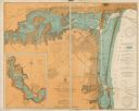
| Date: | 1908 |
|---|---|
| Description: | This map shows streets, industrial buildings, a portion of Lake Superior and other lakes, bays, and rivers in portions of Duluth and Superior. Relief is sh... |

| Date: | 1900 |
|---|---|
| Description: | This map shows streets, railroads, dock and harbor lines, and parks. The map includes population tables for 1880, 1890, 1900. |
If you didn't find the material you searched for, our Library Reference Staff can help.
Call our reference desk at 608-264-6535 or email us at: