 Filter: Categories of Wisconsin Historical Images
Filter: GENRE of Map or Atlas
Filter: County of Brown
Filter: Subject of cities and towns
Filter: Categories of Wisconsin Historical Images
Filter: GENRE of Map or Atlas
Filter: County of Brown
Filter: Subject of cities and towns

| Date: | 08 27 1825 |
|---|---|
| Description: | Map is ink on paper. Map shows plat of the town of Munnomunne, the Fox River, farm lots, and an established highway. The map is signed by "J.D. Doty, Propr... |
| Date: | 1947 |
|---|---|
| Description: | Map shows land ownership, residential zones, commercial zones, and light industrial zones. Includes inset and location map. Also includes zoning ordinance ... |

| Date: | 1950 |
|---|---|
| Description: | Map is ink and color on a photocopied base map. Map shows district limits, proposed future limits, and names of land owners. Base map, by A.A. Porath, show... |

| Date: | 1829 |
|---|---|
| Description: | This map of Munnomonee is ink and pencil on tracing cloth. The map shows a plat of the town, local streets, highways, land donations for public use, and pa... |

| Date: | 1836 |
|---|---|
| Description: | This map of Navarino shows a development plat of the village situated opposite Fort Howard at mouth of the Fox River. The names of proprietors are listed a... |

| Date: | 09 20 1836 |
|---|---|
| Description: | This map is ink and watercolor on paper and is an unnamed plat. Green Bay is labeled and the plat is labeled "Section 22." One road is labeled "Road to Nav... |
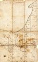
| Date: | 1844 |
|---|---|
| Description: | This map of Township number 24 North, Range 21 East is pen and ink on paper. The map also shows part of Township Number 23 North, Range Number 21 East. The... |

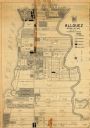
| Date: | 1900 |
|---|---|
| Description: | This map of Green Bay shows plat of the town, lots by number, local streets, the military Fort Howard, part of Fox River and part of Navarino. The map feat... |

| Date: | 1900 |
|---|---|
| Description: | This map of West Navarino shows plat of the town, lots by number, local streets, public square, The Fox River, and Fort Howard. The bottom of the map reads... |

| Date: | 1974 |
|---|---|
| Description: | This map shows roads, highways, railroads, major arterials, towns, parks, recreational areas, and parts of Fox River and bay of Green Bay. The map includes... |

| Date: | 1856 |
|---|---|
| Description: | This map shows a plat of town, local streets, and parts of East and Fox Rivers. |

| Date: | 1868 |
|---|---|
| Description: | This map shows land ownership by name, lots, roads, railroads, and part of the Fox River. The map includes an explanation and table of witnesses to the cor... |

| Date: | 1930 |
|---|---|
| Description: | This map shows a plat of the town, local streets, railroads, creeks, part of Fox River, and part of the bay of Green Bay. The location of the original fort... |
| Date: | 1930 |
|---|---|
| Description: | This map shows local streets, blocks, lots, local businesses by name, and bus stops. On the back of the map is text, illustrations, and aerial views. |

| Date: | 1961 |
|---|---|
| Description: | This map shows established harbor lines, local streets, railroads, U.S. government channel, and part of Fox River. The map includes a table of reference po... |

| Date: | 1987 |
|---|---|
| Description: | This map pictorially shows local roads, local businesses with phone numbers, and parts of Fox River and bay of Green Bay. |

| Date: | 1918 |
|---|---|
| Description: | This map shows railroads, street car lines, wards, private claims, parks, railroad yards and depots, and cemeteries. The map is oriented with north to uppe... |

| Date: | 1931 |
|---|---|
| Description: | This map shows streets and highways, street car and bus lines, railroads, depots, schools, wards, and points of interest. The map is oriented with the nort... |

| Date: | 1946 |
|---|---|
| Description: | This map shows streets, wards and precincts, parks, schools, and points of interest. The map is oriented with north to the upper left. The map includes a s... |

| Date: | 1951 |
|---|---|
| Description: | This map has depths shown by bathymetric tints and soundings and relief shown by contours, the depths are shown in feet. There is an inset map of Green Bay... |
If you didn't find the material you searched for, our Library Reference Staff can help.
Call our reference desk at 608-264-6535 or email us at: