 Filter: Categories of Wisconsin Historical Images
Filter: GENRE of Map or Atlas
Filter: Community of Milwaukee
Filter: Categories of Wisconsin Historical Images
Filter: GENRE of Map or Atlas
Filter: Community of Milwaukee

| Date: | 1965 |
|---|---|
| Description: | This series of 17 maps show boundaries and changes in city limits from 1846 to 1965. The base of all of the maps are the same, Milwaukee and suburbs. All m... |

| Date: | 2005 |
|---|---|
| Description: | This map shows dams and falls, areas of portage, canoe and kayak access, boat launches, parking, restrooms, picnic areas, dining, rapid water, parks, and b... |
| Date: | 1925 |
|---|---|
| Description: | This series of 11 maps plus an index show the rivers as well as riverside buildings, landownership, and streets. |

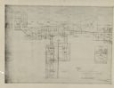
| Date: | 1910 |
|---|---|
| Description: | Sanborn insurance map of Milwaukee showing a portion of Jones Island with Lake Michigan at the top and the Milwaukee River at the bottom. |

| Date: | 1880 |
|---|---|
| Description: | A map of Milwaukee which includes a city street guide. |

| Date: | 1845 |
|---|---|
| Description: | Map of Wisconsin, including lower western border with Iowa, southern border along Illinois, eastern shoreline of Lake Michigan, and northern area along Wis... |
If you didn't find the material you searched for, our Library Reference Staff can help.
Call our reference desk at 608-264-6535 or email us at:

