 Filter: Categories of Wisconsin Historical Images
Filter: GENRE of Map or Atlas
Filter: Community of Milwaukee
Filter: Year of 1900-1999
Filter: Year of 1920-1929
Filter: Categories of Wisconsin Historical Images
Filter: GENRE of Map or Atlas
Filter: Community of Milwaukee
Filter: Year of 1900-1999
Filter: Year of 1920-1929

| Date: | 1927 |
|---|---|
| Description: | Color map, hand-drawn with comic figures engaged in various activities throughout map. Bordered by the river on the left and Lake Michigan on the right, in... |

| Date: | 1922 |
|---|---|
| Description: | A bird's-eye map that shows the Milwaukee Parkway as contemplated by the Milwaukee County Planning Commission. The map identifies the roads and parks throu... |

| Date: | 1927 |
|---|---|
| Description: | Street railway and motor bus map with a legend of "Street Car Line," "Auxiliary Bus Lines," and "Motor Bus Lines." The routes are numbered. The map reads: ... |

| Date: | 1920 |
|---|---|
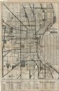
| Description: | This map shows wards, streets, railroads, parks, cemeteries, select buildings, and Lake Michigan. Also included is a street index. Cemeteries and parks are... |

| Date: | 1924 |
|---|---|
| Description: | This map shows streets, selected buildings, railroads, railway yards, schools, parks, schools, cemeteries, bays, the Milwaukee River, and Lake Michigan. De... |

| Date: | 1926 |
|---|---|
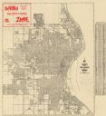
| Description: | This map shows streets, railroads, parks, and cemeteries. The top right includes an advertisement for Bartles-Maguire Oil Co. Wards are colored in red, yel... |

| Date: | 1927 |
|---|---|
| Description: | This map shows street car lines, bus routes, railroads, proposed city boundary lines, wards, public schools, blocks & house numbers, Lake Michigan, one mil... |

| Date: | 1927 |
|---|---|
| Description: | This map shows highways, roads, a proposed annexation, street car lines, bus routes, local motor bus lines, a new high speed interurban, railroads, a propo... |
| Date: | 1929 |
|---|---|
| Description: | This map shows streets, railroads, parks, cemeteries, and a proposed harbor. The top margin includes an advertisement for Delco Motor Oil and the right mar... |
| Date: | 1925 |
|---|---|
| Description: | This map shows the routes of half-day and all-day trips from the Milwaukee area. The map highlights roads, land parcels, routes and destinations. Lake Mic... |

| Date: | 1928 |
|---|---|
| Description: | This map shows a view of the Milwaukee metropolitan area. It highlights state trunk highways, principal county trunks and other secondary highways and type... |

| Date: | 04 1926 |
|---|---|
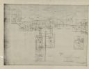
| Description: | This blueprint map shows plats and includes water surface diagram and "history of the harbor." The Kinnickinnic River and the Milwaukee River are labelled.... |
| Date: | 1925 |
|---|---|
| Description: | This series of 11 maps plus an index show the rivers as well as riverside buildings, landownership, and streets. |
If you didn't find the material you searched for, our Library Reference Staff can help.
Call our reference desk at 608-264-6535 or email us at: