 Filter: Categories of Wisconsin Historical Images
Filter: GENRE of Map or Atlas
Filter: Community of Granville
Filter: Categories of Wisconsin Historical Images
Filter: GENRE of Map or Atlas
Filter: Community of Granville
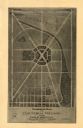
| Date: | 1930 |
|---|---|
| Description: | This map of Granville shows local streets, local businesses, and industrial areas. Some streets are labeled: "Lovers Lane Road," "Granville Road," and "Bro... |

| Date: | 1932 |
|---|---|
| Description: | This map of Granville shows streets, businesses, residential areas, schools, golf courses, and industrial areas. The map shows Granville in March of 1932. ... |

| Date: | 1940 |
|---|---|
| Description: | This map of Granville visually shows different types of zones: agricultural areas, "A" residence, "B" residence, local businesses, commercial and light man... |
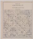
| Date: | 1920 |
|---|---|
| Description: | A plat map of the town of Granville in Milwaukee County, Wisconsin. |
If you didn't find the material you searched for, our Library Reference Staff can help.
Call our reference desk at 608-264-6535 or email us at: