 Filter: Categories of Wisconsin Historical Images
Filter: GENRE of Map or Atlas
Filter: Creator Name of Unknown
Filter: Categories of Wisconsin Historical Images
Filter: GENRE of Map or Atlas
Filter: Creator Name of Unknown

| Date: | 1925 |
|---|---|
| Description: | Sketch of the first floor plan of the house of Mr. Edwin Bottomley. |

| Date: | 1838 |
|---|---|
| Description: | Compiled from the latest authorities. Published by Hinman and Dutton. |

| Date: | 1821 |
|---|---|
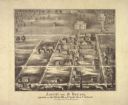
| Description: | Plan of the settlement of Green Bay. |
| Date: | |
|---|---|
| Description: | Series 698, General Land Office Survey Plats, vol. 1. |

| Date: | 1923 |
|---|---|
| Description: | Vilas County. Published by Chicago, Milwaukee, and St. Paul Ry. |

| Date: | 1673 |
|---|---|
| Description: | P. Marquette en Joliet, gedan in't jaar 1673. |

| Date: | 1835 |
|---|---|
| Description: | Constructed for the Topographical Bureau [Wash.], 1835. Scale: 16 miles to 1 inch. Map of a portion of the Indian country lying east and west of the Missis... |

| Date: | |
|---|---|
| Description: | Plat map of the east central part of the city. |

| Date: | |
|---|---|
| Description: | Plan of the battle of the horse shoe bend on the East Pecatonica. |

| Date: | 1904 |
|---|---|
| Description: | A map showing the design for a park fronting on Lake Monona Bay. (Now called Brittingham Park) taken from between pages 44 & 45 of the 1905 Madison Park a... |

| Date: | 1911 |
|---|---|
| Description: | Map of the west part of the city of Madison. |

| Date: | 1916 |
|---|---|
| Description: | Southeastern Wisconsin which lies east of Whitewater and south of Port Washington. |

| Date: | 1821 |
|---|---|
| Description: | A topographical view of the site of Fort Crawford. |

| Date: | |
|---|---|
| Description: | Map of location of bones, used in bison excavation project. |

| Date: | 1857 |
|---|---|
| Description: | Plat map of Kekoskee, Wisconsin. Kekoskee is a village in Dodge County, in the Beaver Dam metropolitan area. The community name derives from Indian term fo... |

| Date: | 06 28 1958 |
|---|---|
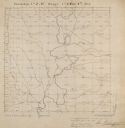
| Description: | Official plat map drawn in ink and watercolor, T. 15 N, R. 11 E. |
| Date: | 1860 |
|---|---|
| Description: | Ansicht Von St Nanianz, gregundet vom Jahr 1854 bis 1860. Sr. Hochw. Hern V. Oschald. n.p., n.d. |
If you didn't find the material you searched for, our Library Reference Staff can help.
Call our reference desk at 608-264-6535 or email us at:


