Filter: Categories of Wisconsin Historical Images
Filter: GENRE of Drawing
Filter: Subject of intellectual life
Filter: Categories of Wisconsin Historical Images
Filter: GENRE of Drawing
Filter: Subject of intellectual life

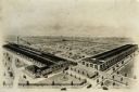
| Date: | 1907 |
|---|---|
| Description: | Bird's-eye view of the University of Wisconsin-Madison campus looking northwest. Building at top of hill, to left of center is Bascom Hill (Main Hall) and... |

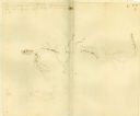
| Date: | 07 1838 |
|---|---|
| Description: | A map diagram of Indian effigy mounds seven miles east of Blue Mounds in the Wisconsin Territory. |
| Date: | 01 11 1805 |
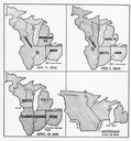
|---|---|
| Description: | Four map illustrations showing the political subdivisions of the Northwest Territory from 1805 through 1834. |
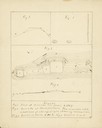
| Date: | |
|---|---|
| Description: | Drawing of a time saving chart for one day's labor in a sawyard shop. |

| Date: | |
|---|---|
| Description: | Jane Addams holding an open book, surrounded by immigrant children. |

| Date: | 1780 |
|---|---|
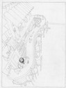
| Description: | Hand-drawn plan for the layout of the town of Clarksville, bordering Mayfield Creek and Liberty Creek. Fort Jefferson is shown between the townsite and the... |

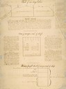
| Date: | 1780 |
|---|---|
| Description: | Plan for layout of 150,00 acres which make up Clark's Illinois Grant. |
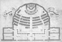
| Date: | 1860 |
|---|---|
| Description: | Floor plan and seating chart for the Assembly for their first meeting in the East Wing of new Wisconsin State Capitol building. After the completion of th... |

| Date: | 08 24 1876 |
|---|---|
| Description: | Hand-drawn plan of the battleground of Huycks. |

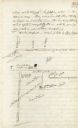
| Date: | 03 26 1876 |
|---|---|
| Description: | Hand-drawn map showing the place of Hook's defeat in York County in South Carolina. |
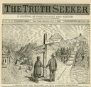
| Date: | 07 06 1889 |
|---|---|
| Description: | Illustration depicting a boy and a girl joining hands at a crossroads, with a choice of "The Freethought Road" or "The Orthodox Route". |
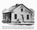
| Date: | 1857 |
|---|---|
| Description: | Green Bay Intelligencer Newspaper Office. This was the first newspaper published in Wisconsin. The building was on Main Street. This drawing appeared in an... |
| Date: | |
|---|---|
| Description: | Plat map of Mammoth Cave. A note on the map reads: "Mrs. Campbell conjectures that this is a saltpeter cave in Green River, Kentucky. The mummy found in it... |
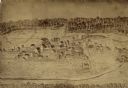
| Date: | 1921 |
|---|---|
| Description: | Bird's-eye view of the Winther Motor and Truck Company factory and grounds. |
If you didn't find the material you searched for, our Library Reference Staff can help.
Call our reference desk at 608-264-6535 or email us at: