 Filter: Categories of Wisconsin Historical Images
Filter: Subject of indians of north america
Filter: Year of 1900-1999
Filter: Type of Map or Atlas
Filter: Year of 1970-1979
Filter: Categories of Wisconsin Historical Images
Filter: Subject of indians of north america
Filter: Year of 1900-1999
Filter: Type of Map or Atlas
Filter: Year of 1970-1979

| Date: | 1979 |
|---|---|
| Description: | A map of Southern Wisconsin and northern Illinois showing the areas inhabited by the Ho-Chuck, formerly known as the Winnebago. Some of the location names ... |

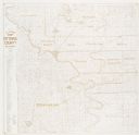
| Date: | 1974 |
|---|---|
| Description: | This 1968 map identifies resorts in the Lac du Flambeau Indian Reservation region of Wisconsin, covering parts of Iron, Vilas, Oneida, and Price counties. ... |

| Date: | 1974 |
|---|---|
| Description: | Map of Wisconsin with drawings illustrating historic places and events throughout the state. The Great Seal of the State of Wisconsin appears at the top ri... |

| Date: | 1975 |
|---|---|
| Description: | This map shows boundaries, roads, national forest land, bogs and wetlands, lakes, campgrounds, and boat landings. |

| Date: | 1970 |
|---|---|
| Description: | This map shows land owned by Menominee Enterprise Inc., land sold to Menominee shareholders, and land sold to non-Menominees. The map also includes water a... |

| Date: | 1974 |
|---|---|
| Description: | This map draws content from a map originally created by George Featherstongaugh in 1840. The map shows streets, land ownership, the Brotherton Indian reser... |

| Date: | 1972 |
|---|---|
| Description: | This colored map displays Wisconsin and bordering areas of Iowa, Minnesota, and Michigan. There is color-coding on the map to indicate National Forests, an... |

| Date: | 1971 |
|---|---|
| Description: | This colored map displays Wisconsin and bordering areas of Iowa, Minnesota, and Michigan. There is color-coding on the map to indicate National Forests, an... |

| Date: | 1973 |
|---|---|
| Description: | This colored map displays Wisconsin and bordering areas of Iowa, Minnesota, and Michigan. There is color-coding on the map to indicate National Forests, a... |
| Date: | 1978 |
|---|---|
| Description: | A map showing allotments of American Indian tribes in Ottawa County, Oklahoma. On the left side is a listing of Lead & Zinc Mines. |
If you didn't find the material you searched for, our Library Reference Staff can help.
Call our reference desk at 608-264-6535 or email us at:

