 Filter: Categories of Wisconsin Historical Images
Filter: Subject of education
Filter: Subject of wetlands
Filter: Categories of Wisconsin Historical Images
Filter: Subject of education
Filter: Subject of wetlands

| Date: | 1888 |
|---|---|
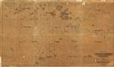
| Description: | This late 19th century map of Price County, Wisconsin, shows landownership and waterfront acreages, the township and range system, towns, cities and villag... |

| Date: | 1902 |
|---|---|
| Description: | This 1902 map of the eastern portion of Sawyer County, Wisconsin, shows the township and range system, sections, roads, farm houses, camps, school houses, ... |

| Date: | 1871 |
|---|---|
| Description: | This map of Barron County, Wisconsin, shows the township and range grid, towns, sections, cities and villages, post offices, dwellings, schools, roads, swa... |
| Date: | 1900 |
|---|---|
| Description: | This map of Taylor County, Wisconsin, shows landownership, the township and range grid, towns, sections, cities and villages, railroads, tanneries, cemeter... |

| Date: | 1896 |
|---|---|
| Description: | This 1896 map of Washburn County, Wisconsin, shows the township and range grid, sections, schools, wagon roads, cities and villages, settlers, railroads, a... |

| Date: | 1916 |
|---|---|
| Description: | This 1916 map of Washburn County, Wisconsin, shows the township and range grid, sections, towns, schools, wagon roads, cities and villages, post offices, s... |
| Date: | 1900 |
|---|---|
| Description: | This map from the turn of the 20th century shows the township and range grid, sections, towns, land owned by the Starks Levis Land Company of Madison, scho... |

| Date: | 1898 |
|---|---|
| Description: | This 1898 map of Ashland County, Wisconsin, shows the township and range grid, towns, sections, cities and villages, landownership, roads, railroads, swamp... |

| Date: | 1882 |
|---|---|
| Description: | This 1882 map of Barron County, Wisconsin, shows the township and range grid, towns, cities and villages, wagon roads, railroads, schools, dwellings, and l... |

| Date: | 1861 |
|---|---|
| Description: | This 1861 map of Columbia County, Wisconsin, shows the township and range grid, towns, sections, cities and villages, railroads, roads, property owners and... |

| Date: | 1889 |
|---|---|
| Description: | This 1889 map of Douglas County, Wisconsin, shows the township and range grid, towns, sections, cities and villages, roads, existing and proposed railroads... |

| Date: | 1873 |
|---|---|
| Description: | This late 19th century map shows the lake region around Oconomowoc in Waukesha County and eastern Jefferson County, Wisconsin. The township and range grid,... |

| Date: | 1891 |
|---|---|
| Description: | This late 19th century map shows the lake region around Oconomowoc in Waukesha County and eastern Jefferson County, Wisconsin. The township and range grid,... |

| Date: | 1876 |
|---|---|
| Description: | This late 19th century map by Increase Lapham shows the lake region around Oconomowoc in Waukesha County and eastern Jefferson County, Wisconsin. Cities an... |

| Date: | 1887 |
|---|---|
| Description: | This late 19th century map shows the lake region around Oconomowoc in Waukesha County and eastern Jefferson County, Wisconsin. Cities and villages, roads, ... |

| Date: | 1878 |
|---|---|
| Description: | This 1878 map of Wood County, Wisconsin, shows the township and range grid, towns, sections, cities, villages and post offices, landownership, roads, railr... |

| Date: | 1873 |
|---|---|
| Description: | This 1873 map of Chippewa County, Wisconsin, which at the time also encompassed all or part of Price, Rusk, Sawyer, and Taylor counties, shows the township... |

| Date: | 1929 |
|---|---|
| Description: | This 1929 topographic map of Trempealeau County, Wisconsin, shows the topography, lakes, streams and wetlands, township and range grid, sections, cities an... |

| Date: | 1928 |
|---|---|
| Description: | This 1928 topographic map of Vernon County, Wisconsin, shows relief, lakes, streams and wetlands, the township and range grid, sections, cities and village... |

| Date: | 1896 |
|---|---|
| Description: | This 1896 map of Douglas County, Wisconsin, shows the township and range grid, the towns of Superior, Brule, Gordon, and Nebagamain, sections, cities and v... |
If you didn't find the material you searched for, our Library Reference Staff can help.
Call our reference desk at 608-264-6535 or email us at: