| Date: | 1868 |
|---|---|
| Description: | This 1868 birds-eye view depicts the buildings, streets, railroad, vegetation and topography of Columbus, Wisconsin. The high school, cemetery, railroad de... |

| Date: | 1867 |
|---|---|
| Description: | Bird's-eye map of Green Bay and Fort Howard, Brown Co., depicts street names and street layouts, houses, trees, and the East River. A reference key at the ... |

| Date: | 1870 |
|---|---|
| Description: | Bird's-eye map of Hudson, with insets of Court House and Public School. |

| Date: | 1880 |
|---|---|
| Description: | Bird's-eye map over the Mississippi River of Fountain City. Paddle steamers and steamboats are on the river, and bluffs are in the background. |

| Date: | 1910 |
|---|---|
| Description: | Bird's-eye view looking east, with Washburn Harbor at center and Chequamegon Bay in Lake Superior covering most of the upper image. Streets with buildings... |

| Date: | 1870 |
|---|---|
| Description: | Elevated view of the town, looking northwest. The Chippewa River is in the foreground, with a lot of buildings, an intersection, and distant hills. One bui... |

| Date: | 02 06 1948 |
|---|---|
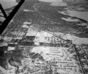
| Description: | Looking east along Regent Street with snow on the ground. Visible are Lake Wingra, Monona Bay, railroad causeway across Monona, Lake Mendota, Hoyt Park, We... |

| Date: | 1876 |
|---|---|
| Description: | Elevated view of building on the University of Wisconsin-Madison campus, which is located on a hill near Lake Mendota. A winding drive leads up to the hous... |

| Date: | 1915 |
|---|---|
| Description: | Elevated view, looking north, from the Hotz family compound near the bluff entrance to Fish Creek. Evergreens and bare birch trees stand in the foreground,... |

| Date: | 1980 |
|---|---|
| Description: | Aerial view of Capitol Square and the surrounding central isthmus. Lake Monona is on the right. |
If you didn't find the material you searched for, our Library Reference Staff can help.
Call our reference desk at 608-264-6535 or email us at: