 Filter: Categories of Wisconsin Historical Images
Filter: Subject of education
Filter: Subject of cheese
Filter: Categories of Wisconsin Historical Images
Filter: Subject of education
Filter: Subject of cheese

| Date: | 1896 |
|---|---|
| Description: | A hand-colored Map of Jefferson County, Wisconsin, shows township and section divisions, towns, villages and post offices, rural residents, railroads, road... |

| Date: | 1928 |
|---|---|
| Description: | Shows different types of roads, railroads, schools, churches, farmsteads, cheese factories, mine shafts, old surface workings, streams, old sulphur pits, a... |
| Date: | |
|---|---|
| Description: | Put aside anything so futile All that fermented time spent and blackened, much obscured, is now restored with cheese and wine |

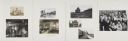
| Date: | 02 01 1955 |
|---|---|
| Description: | School children from the Madison area are among the first visitors at the opening of the $100,000 Dairy Caravan at the State Capitol. Maple Grove pupils ob... |
If you didn't find the material you searched for, our Library Reference Staff can help.
Call our reference desk at 608-264-6535 or email us at: