 Filter: Categories of Wisconsin Historical Images
Filter: Subject of education
Filter: Type of Map or Atlas
Filter: Categories of Wisconsin Historical Images
Filter: Subject of education
Filter: Type of Map or Atlas

| Date: | 1929 |
|---|---|
| Description: | This 1929 topographic map of Trempealeau County, Wisconsin, shows the topography, lakes, streams and wetlands, township and range grid, sections, cities an... |

| Date: | 1928 |
|---|---|
| Description: | This 1928 topographic map of Vernon County, Wisconsin, shows relief, lakes, streams and wetlands, the township and range grid, sections, cities and village... |

| Date: | 1910 |
|---|---|
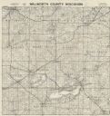
| Description: | Map shows routes, post offices, houses, churches, roads, and schools."June 1, 1910. E.G."Blue line print."Walworth Co., Wis. 451" -- bottom margin. |
| Date: | 1956 |
|---|---|
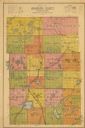
| Description: | Map shows townships and sections, landownership and acreages, roads, schools, churches, and cemeteries. |
| Date: | 1938 |
|---|---|
| Description: | Map shows roads, townships and sections, railroads, water, and schools. |

| Date: | 1873 |
|---|---|
| Description: | This 1874 map of Washington and Ozaukee counties, Wisconsin, shows the township and range grid, towns, sections, cities and villages, rural landownership a... |

| Date: | 1874 |
|---|---|
| Description: | This 1873 map covers the northern halves (Towns 11 and 12) of Washington and Ozaukee counties. Shown are the township and range grid, towns, sections, citi... |

| Date: | 1910 |
|---|---|
| Description: | This 1910 map from the U.S. Post Office Dept. shows rural delivery routes, active and discontinued post offices, collection boxes, selected rural landowner... |

| Date: | 1929 |
|---|---|
| Description: | Map shows townships and sections, landownership and acreages, roads, schools, school districts, churches, and cemeteries. Includes index of acreage tracts. |

| Date: | 1900 |
|---|---|
| Description: | This 1900 map of Waukesha County, Wisconsin, shows the township and range grid, towns, sections, cities and villages, rural landowners and acreages, railro... |

| Date: | 1911 |
|---|---|
| Description: | This 1911 map from the U.S. Post Office Dept. shows rural delivery routes, active and discontinued post offices, selected rural landowners and houses, chur... |

| Date: | 1898 |
|---|---|
| Description: | Map showing the contour depths of the lakes in northwestern Waukesha County, Wisconsin. Roads, railroads, depots, churches, schools, and hotels in the area... |

| Date: | 1873 |
|---|---|
| Description: | This 1873 map of Winnebago County, Wisconsin, shows the township and range grid, towns, sections, cities and villages, landownership and acreages, roads, r... |

| Date: | 1897 |
|---|---|
| Description: | This 1897 map of Winnebago County, Wisconsin, shows the township and range grid, towns, sections, cities and villages, landownership and acreages, rural re... |

| Date: | 1911 |
|---|---|
| Description: | This 1911 map from the U.S. Post Office Dept. shows rural delivery routes, active and discontinued post offices, collection boxes, selected rural landowner... |

| Date: | 1915 |
|---|---|
| Description: | This 1915 map covers the section of the Wisconsin River in southern Adams, southeastern Juneau, northeastern Sauk, and northwestern Columbia counties. A po... |

| Date: | 1877 |
|---|---|
| Description: | Shows land ownership by name, churches, schools, farm houses, wagon roads, railroads. Includes directory of businesses for Columbus, Portage, Doylestown, W... |

| Date: | 1911 |
|---|---|
| Description: | Blue line print. Shows post offices, houses, schools, churches, roads, routes, rivers, and railroads. Includes explanation of symbols. "H.G.M. October 12,... |

| Date: | 1914 |
|---|---|
| Description: | Shows land ownership by name, rural routes, improved roads, railroads, schools, churches, and cemeteries. "For list of small property owners, lift map at f... |
| Date: | 1907 |
|---|---|
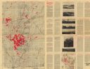
| Description: | "Lands colored in red owned and for sale by J.L. Gates Land Company, Milwaukee, Wis." Also shows wagon roads, railroads, schools, and settlers. On verso: M... |
If you didn't find the material you searched for, our Library Reference Staff can help.
Call our reference desk at 608-264-6535 or email us at: