 Filter: Categories of Wisconsin Historical Images
Filter: Subject of education
Filter: Type of Map or Atlas
Filter: Categories of Wisconsin Historical Images
Filter: Subject of education
Filter: Type of Map or Atlas

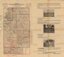
| Date: | 1896 |
|---|---|
| Description: | This 1896 map of Washburn County, Wisconsin, shows the township and range grid, sections, schools, wagon roads, cities and villages, settlers, railroads, a... |

| Date: | 1909 |
|---|---|
| Description: | This 1909 revision of Harmon's 1896 map of Washburn County, Wisconsin, shows the township and range grid, towns, sections, schools, wagon roads, cities and... |

| Date: | 1916 |
|---|---|
| Description: | This 1916 map of Washburn County, Wisconsin, shows the township and range grid, sections, towns, schools, wagon roads, cities and villages, post offices, s... |
| Date: | 1900 |
|---|---|
| Description: | This map from the turn of the 20th century shows the township and range grid, sections, towns, land owned by the Starks Levis Land Company of Madison, scho... |

| Date: | 1898 |
|---|---|
| Description: | This 1898 map of Ashland County, Wisconsin, shows the township and range grid, towns, sections, cities and villages, landownership, roads, railroads, swamp... |

| Date: | 1882 |
|---|---|
| Description: | This 1882 map of Barron County, Wisconsin, shows the township and range grid, towns, cities and villages, wagon roads, railroads, schools, dwellings, and l... |

| Date: | 1906 |
|---|---|
| Description: | This 1906 map of Bayfield County, Wisconsin, shows towns, sections, cities, villages and post offices, land ownership, wagon roads, railroads, schools, gov... |

| Date: | 1960 |
|---|---|
| Description: | This mid-20th century tourist brochure for Bayfield County, Wisconsin, includes a map of the county showing towns, cities and villages, highways and roads,... |

| Date: | 1967 |
|---|---|
| Description: | This tourist brochure for Bayfield County, Wisconsin, from 1967 includes a map of the county showing towns, cities and villages, highways and roads, railro... |

| Date: | 1870 |
|---|---|
| Description: | This 1870 map of Brown County, Wisconsin, shows the township and range grid, towns, sections, cities, villages and post offices, land ownership, roads, rai... |

| Date: | 1896 |
|---|---|
| Description: | This map of Brown County, Wisconsin, from the late 19th century shows land claims along the Fox River, the township and range grid, towns, sections, cities... |

| Date: | 1900 |
|---|---|
| Description: | This early 20th century map of Chippewa County, Wisconsin, shows the township and range grid, towns, sections, cities and villages, roads, railroads, schoo... |

| Date: | 1918 |
|---|---|
| Description: | This 1918 map of Chippewa County, Wisconsin, shows the township and range grid, towns, sections, cities and villages, rural residences, churches, schools, ... |

| Date: | 1914 |
|---|---|
| Description: | This early-20th century map of Clark County, Wisconsin, shows the township and range grid, sections, cities and villages, wagon roads, railroads, settlers,... |

| Date: | 1861 |
|---|---|
| Description: | This 1861 map of Columbia County, Wisconsin, shows the township and range grid, towns, sections, cities and villages, railroads, roads, property owners and... |

| Date: | 1878 |
|---|---|
| Description: | This map of Crawford County, Wisconsin, shows the township and range grid, sections, towns, cities and villages, land ownership and acreages, roads, railro... |

| Date: | 1904 |
|---|---|
| Description: | This 1904 map of Dane County, Wisconsin, shows postal routes, post office locations, towns, sections, cities and villages, roads, railroads, collection box... |

| Date: | 1896 |
|---|---|
| Description: | This late 19th-century map of Dodge County, Wisconsin, shows the township and range grid, towns, sections, cities, villages and post offices, some property... |

| Date: | 1905 |
|---|---|
| Description: | This early 20th century map of Door County, Wisconsin, shows the township and range grid, towns, sections, cities and villages, landownership and acreages,... |

| Date: | 1944 |
|---|---|
| Description: | Shows roads, railroads, schools, dairy plants, seaplane bases, wayside parks, and commercial/municipal fields. "Marathon Forms Map Service, Wisconsin repre... |
If you didn't find the material you searched for, our Library Reference Staff can help.
Call our reference desk at 608-264-6535 or email us at: