 Filter: Categories of Wisconsin Historical Images
Filter: Subject of Wisconsin State Capitol
Filter: Subject of railroads
Filter: Categories of Wisconsin Historical Images
Filter: Subject of Wisconsin State Capitol
Filter: Subject of railroads

| Date: | 1908 |
|---|---|
| Description: | Colored map showing a panoramic view of Madison in great detail. The Wisconsin State Capitol is located at the center, with Lake Mendota in the background ... |
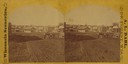
| Date: | 1874 |
|---|---|
| Description: | View looking southwest down the 600 block of Williamson Street to the East Madison Passenger Depot of the Chicago & Northwestern Railroad. There are frame ... |

| Date: | 1867 |
|---|---|
| Description: | Bird's-eye map of Madison with insets of the University, Rasdall House, Vilas House, and the Wisconsin State Capitol. View includes cattail marsh, smokesta... |

| Date: | 1885 |
|---|---|
| Description: | Bird's-eye map of Madison, State Capital of Wisconsin, County Seat of Dane County, with inset of the Wisconsin State Capitol. |

| Date: | 1855 |
|---|---|
| Description: | Part of George Harrison's "Map of the City of Madison," showing the development of the isthmus and the small size of the second Capitol (54' x 104') in com... |

| Date: | 1855 |
|---|---|
| Description: | Map of the city of Madison, Dane County, published by George Harrison, surveyed and drawn by P. McCabe, and engraved by J.H. Colton & Co., New York. In add... |

| Date: | 02 09 1949 |
|---|---|
| Description: | Aerial view of Madison, looking east across the Isthmus including the Wisconsin State Capitol, Lake Mendota, and Lake Monona. |

| Date: | 1953 |
|---|---|
| Description: | A map of Lake Mendota that shows depths and the locations of various species of fish in lake. The maps also identifies a number of selected roads and stree... |

| Date: | 1928 |
|---|---|
| Description: | Illustrated map of points of interest, including University buildings, parks, athletic venues, fraternity and sorority houses, and state buildings. |

| Date: | 1899 |
|---|---|
| Description: | A map of the west part of the city of Madison, including University Heights and the Capitol Square. |

| Date: | 1967 |
|---|---|
| Description: | Air view looking north toward Lake Mendota. The intersection of West Washington Ave. and S. Park Street is at bottom center. The Triangle Redevelopment Pro... |

| Date: | |
|---|---|
| Description: | Aerial view looking south over Lake Mendota towards the isthmus and beyond. Sailboats and other boats are on the lake. The view is centered at Wisconsin Av... |
If you didn't find the material you searched for, our Library Reference Staff can help.
Call our reference desk at 608-264-6535 or email us at:
