 Filter: Categories of Wisconsin Historical Images
Filter: Subject of Wisconsin River (Wis.)
Filter: Type of Map or Atlas
Filter: Categories of Wisconsin Historical Images
Filter: Subject of Wisconsin River (Wis.)
Filter: Type of Map or Atlas

| Date: | 1760 |
|---|---|
| Description: | This map shows lakes, rivers, forts, settlements, and Native American tribal territory. The southern boundary of the Hudsons Bay Company is labeled. Relief... |

| Date: | 1839 |
|---|---|
| Description: | This map, one of a series made by Thomas Jefferson Cram of the U.S. Topographical Engineers from personal surveys, covers the area from Green Bay to the ju... |

| Date: | 1837 |
|---|---|
| Description: | This map shows the planned military posts/depots, roads, existing forts, rivers, and land assigned to various Indian tribes. Illinois, Mississippi, Arkansa... |

| Date: | 1837 |
|---|---|
| Description: | This map shows planned military posts/depots, barracks, rivers, lakes, roads, existing forts, and land assigned to various Indian tribes. Arkansas, Illinoi... |

| Date: | 1910 |
|---|---|
| Description: | This map shows shoreline lot numbers and acreages, the Wisconsin River, and the Michigan and Wisconsin state line. Manuscript annotations relating to topon... |

| Date: | 1950 |
|---|---|
| Description: | This blueline print shows roads and proposed roads in parts of the Towns of Carson, Hull, Linwood, and Plover, as well as boundaries and lines demarking ex... |

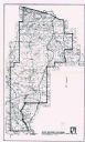
| Date: | 1851 |
|---|---|
| Description: | This map shows labeled counties in Wisconsin and unlabeled county in Michigan. It includes Door County, which was established 1851, but lacks Kewaunee Coun... |

| Date: | 05 16 1994 |
|---|---|
| Description: | The front side of this map shows roads, highways, the Wisconsin River, Stevens Point Airport, and surrounding towns. A street index is included along the r... |

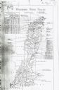
| Date: | 1868 |
|---|---|
| Description: | This map shows the configurations of the counties, communities, railroads and projected railroads, mines, shipping routes, and labeled rivers and lakes. Po... |
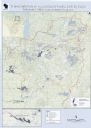
| Date: | 2013 |
|---|---|
| Description: | This map shows hydroelectric dams, natural-lake and man-made reservoirs, the Wisconsin River and its tributaries, and the Wisconsin River Drainage Basin. T... |
| Date: | 1911 |
|---|---|
| Description: | This map includes references to reservoirs, industrial sites, and drainage basins. |

| Date: | 1829 |
|---|---|
| Description: | This map shows waterways, trails, settlements, Indian villages, and boundaries. The map includes text in the lower left with excerpts from Indian land trea... |
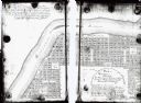
| Date: | 1900 |
|---|---|
| Description: | This map shows lots, public squares, landing, streets, and promenade of a paper city on a site now in the Town of West Point, Columbia County. The Wisconsi... |

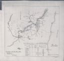
| Date: | 08 1960 |
|---|---|
| Description: | This map shows a detailed account of southwestern Wisconsin. Individual settlers, the type of trees that grow in given areas, the quality of the soil (labe... |

| Date: | 1900 |
|---|---|
| Description: | This map shows distances and land use along Dekorra and Sauk-Harbour road. It covers road between areas currently known as Dekorra and Port Washington, Wis... |

| Date: | 1900 |
|---|---|
| Description: | This map shows portion of the military road from Fond du Lac to the Wisconsin River near Fort Winnebago, with mile markers and adjacent land use. A few pro... |
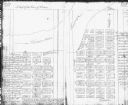
| Date: | 1900 |
|---|---|
| Description: | This Plat map shows the second location of Helena's (of three) on the banks of the Wisconsin River. It also shows the location of shot tower northeast of t... |

| Date: | 1847 |
|---|---|
| Description: | This hand-colored map shows area north and west of Wisconsin River and south and east of Saint Louis and upper Mississippi Rivers. |
| Date: | 1976 |
|---|---|
| Description: | This map shows Wisconsin River Watershed, adjacent watersheds, and railroads in parts of Vilas, Oneida, Forest, Lincoln, Langlade, Marathon, Wood, Portage,... |
| Date: | 1897 |
|---|---|
| Description: | This map shows the distances along Fox River, as well as adjacent lakes and railroads, between Green Bay and the Wisconsin River. Lake Michigan is on the f... |
If you didn't find the material you searched for, our Library Reference Staff can help.
Call our reference desk at 608-264-6535 or email us at: