 Filter: Categories of Wisconsin Historical Images
Filter: Subject of Wisconsin
Filter: Subject of surveying
Filter: Categories of Wisconsin Historical Images
Filter: Subject of Wisconsin
Filter: Subject of surveying
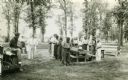
| Date: | 1937 |
|---|---|
| Description: | Probably Native Americans receiving instructions on compass use for Wisconsin Land Economic Inventory. |

| Date: | 1851 |
|---|---|
| Description: | A survey map of Wisconsin and eastern Minnesota, with the township surveys for portions of the Saint Croix region in progress. The maps also show the Meno... |

| Date: | 1864 |
|---|---|
| Description: | This map of the entire state of Wisconsin depicts the township survey grid and identifies counties, named towns, cities and villages, rivers, lakes, railro... |

| Date: | 1850 |
|---|---|
| Description: | Diagrams of four effigy mounds surveyed by Increase A. Lapham and W.H. Canfield in 1850. No. 1 is an unidentified animal shape, No. 2 consists of two linea... |
If you didn't find the material you searched for, our Library Reference Staff can help.
Call our reference desk at 608-264-6535 or email us at: