| Date: | 1892 |
|---|---|
| Description: | This map shows pipes of various sizes, hydrants with hydrant pressure, valves, wells, and projected lines. Includes labels for roadways, blocks, wards, par... |

| Date: | |
|---|---|
| Description: | Exterior view of the water works building. Flowers are planted along the front, and lampposts are flanking the entrance. Caption reads: "Water Works, La Cr... |

| Date: | |
|---|---|
| Description: | A man is operating a drill to create a well near a home under construction. |

| Date: | 04 1901 |
|---|---|
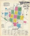
| Description: | A Sanborn map of Watertown, including an index and a key. |

| Date: | 11 07 1949 |
|---|---|
| Description: | Subject: "Pipe Lines — TD-6." Where Taken: "NE." Information with photograph reads: "TD-6 owned by J.J. Struzziery-General Contractors, 115 Kittredge St., ... |
If you didn't find the material you searched for, our Library Reference Staff can help.
Call our reference desk at 608-264-6535 or email us at: