 Filter: Categories of Wisconsin Historical Images
Filter: Subject of Water
Filter: Creator Name of Walling, Henry Francis
Filter: Categories of Wisconsin Historical Images
Filter: Subject of Water
Filter: Creator Name of Walling, Henry Francis
| Date: | 1858 |
|---|---|
| Description: | This map made up of six panels shows communities, rivers, and Lake Michigan. The map includes several inset maps showing Milwaukee, Humboldt, Franklin, Oak... |

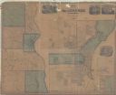
| Date: | 1859 |
|---|---|
| Description: | This hand-colored map shows township and range in pink, blue, yellow, and orange, land ownership, includes 16 city inset maps showing land ownership, and 5... |
If you didn't find the material you searched for, our Library Reference Staff can help.
Call our reference desk at 608-264-6535 or email us at: