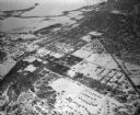
| Date: | 02 06 1948 |
|---|---|
| Description: | Aerial photograph of Madison's west side looking northeast along Speedway Road. Visible are Forest Hill and Resurrection Cemeteries, West High School, Hoyt... |

| Date: | 08 1918 |
|---|---|
| Description: | Workers at the site of two graves discovered on Bascom Hill in front of Main Hall (now Bascom Hall). One man sprays water from a hose. The disturbed soil o... |

| Date: | 08 1918 |
|---|---|
| Description: | Excavation site of two graves discovered on Bascom Hill during preparation for placement of the Abraham Lincoln monument circle. The legs and shoes of a ma... |

| Date: | 1971 |
|---|---|
| Description: | This map shows streets, highways, railroads, parks, colleges, cemeteries, county clubs, University of Wisconsin, Truax Field, Middleton, Shorewood Hills, M... |
If you didn't find the material you searched for, our Library Reference Staff can help.
Call our reference desk at 608-264-6535 or email us at: