 Filter: Categories of Wisconsin Historical Images
Filter: Subject of Transportation, Military
Filter: Year of 1900-1999
Filter: Type of Map or Atlas
Filter: Categories of Wisconsin Historical Images
Filter: Subject of Transportation, Military
Filter: Year of 1900-1999
Filter: Type of Map or Atlas

| Date: | 1928 |
|---|---|
| Description: | Map of portions of Wisconsin and Minnesota between Lake Superior and Mississippi River, showing railroads and military road. |
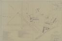
| Date: | 1947 |
|---|---|
| Description: | Map includes a legend identifying four types of runway lights for aircraft, and a building index. The map includes an inset of the site and location plan. ... |
If you didn't find the material you searched for, our Library Reference Staff can help.
Call our reference desk at 608-264-6535 or email us at: