 Filter: Categories of Wisconsin Historical Images
Filter: Subject of Transportation
Filter: Creator Name of Vilas, Moses
Filter: Categories of Wisconsin Historical Images
Filter: Subject of Transportation
Filter: Creator Name of Vilas, Moses
| Date: | 1845 |
|---|---|
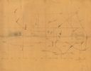
| Description: | This manuscript map, drawn about 1845, shows the township and range grid, villages, post offices, and roads in Kenosha, Racine, and Walworth counties and i... |
If you didn't find the material you searched for, our Library Reference Staff can help.
Call our reference desk at 608-264-6535 or email us at: