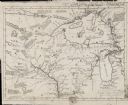
| Date: | 1769 |
|---|---|
| Description: | Manuscript map. Scale: about 80 British statue miles to 1 inch. |

| Date: | 1778 |
|---|---|
| Description: | Hand-colored. London, 1778. Coordinates: W 99⁰--W 83⁰/N 49⁰--N 41⁰. Scale [ca. 1:3,500,000] |
If you didn't find the material you searched for, our Library Reference Staff can help.
Call our reference desk at 608-264-6535 or email us at: