 Filter: Categories of Wisconsin Historical Images
Filter: Subject of Trails
Filter: Year of 2000-Present
Filter: Year of 2000-2009
Filter: Categories of Wisconsin Historical Images
Filter: Subject of Trails
Filter: Year of 2000-Present
Filter: Year of 2000-2009
| Date: | 2000 |
|---|---|
| Description: | The Sandwalk of Charles Darwin, at the Darwin residence in Kent, England. |
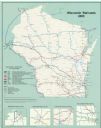
| Date: | 2000 |
|---|---|
| Description: | This map shows railroads by operating freight and government agencies, Amtrak stations, ports, rail lines out of service, rail banks, and Rails-to-Trails. ... |

| Date: | 2003 |
|---|---|
| Description: | The front of map shows trails throughout the bottom half of Wisconsin and includes text on snowmobile rules and tourism contacts. The reverse shows trails ... |
| Date: | 2007 |
|---|---|
| Description: | The front of map shows trails throughout the bottom half of Wisconsin and includes text on snowmobile rules and tourism contacts. The reverse shows trails ... |

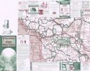
| Date: | 2006 |
|---|---|
| Description: | This map includes indexed advertisements and map of the Lac du Flambeau region on back. The map is broken into 9 zones, each marked with state and club tra... |
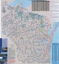
| Date: | 2001 |
|---|---|
| Description: | This map shows county boundaries, cities, roads, and bikes trails in the west-central region in Wisconsin. Portions of Minnesota and Iowa are visible. Inc... |

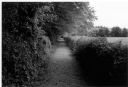
| Date: | 2000 |
|---|---|
| Description: | Looking downhill on flagstone and wood plank path edged by giant birch trees, as well as grasses and evergreens. |
If you didn't find the material you searched for, our Library Reference Staff can help.
Call our reference desk at 608-264-6535 or email us at: