
| Date: | 1960 |
|---|---|
| Description: | This manuscript map of Taylor County, Wisconsin, shows the township and range grid, lakes and streams, "Chippewa trails, Indian trails" Indian villages and... |

| Date: | 1836 |
|---|---|
| Description: | Map shows rivers, creeks, roads, trails, mills, and town of Madison. Includes significant manuscript annotations; Sheet 1 is watercolor on lithographed map... |
| Date: | 1902 |
|---|---|
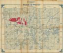
| Description: | Shows swamps, lakeside acreages, railroads, trails, and townships in parts of Vilas and Iron Counties, Wisconsin and Gogebic County, Michigan. Relief shown... |

| Date: | 1909 |
|---|---|
| Description: | This 1909 map of northern Wisconsin and a portion of Michigan's Upper Peninsula shows the Lac du Flambeau Indian Reservation, cities and villages, railroad... |
| Date: | 1929 |
|---|---|
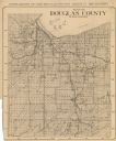
| Description: | "Compliments of the Douglas County Highway Department"--Top margin. Shows state-trunk highways, county highways, town roads, trails, boundaries, and concr... |
| Date: | 1953 |
|---|---|
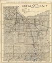
| Description: | "Compliments of the Douglas County Highway Department"--Top margin. Shows federal highways, state trunk highways, county highways, town roads, unimproved ... |

| Date: | 1986 |
|---|---|
| Description: | This late 1980s map of Price County, Wisconsin, shows facilities and lands open for public recreation, hunter walking trails and ski trails, campgrounds, b... |

| Date: | 1975 |
|---|---|
| Description: | This map shows settlers, Indian trails, roads, marshes, and forests as they appeared in 1800-1840. "A bicentennial map of Racine County for the benefit of ... |

| Date: | 1973 |
|---|---|
| Description: | Map shows sections, trails, roads, and locations of ancient burial grounds, hills, groves, and settlers. Printed in brown ink. |

| Date: | 1835 |
|---|---|
| Description: | Shows Walker’s Point, Juneau Town and Kilbourn Town, including labeled buildings, trails and Indian villages. Relief shown by hachures. Oriented with north... |

| Date: | 1836 |
|---|---|
| Description: | This map shows settlers houses and businesses, trails, and swamps. The relief is shown by hachures. The map includes illustrations of historical buildings ... |

| Date: | 1970 |
|---|---|
| Description: | Map features a legend of roads, trails, points of interest, buildings, and types of vegetation. To the right are "ARBORETUM REGULATIONS" regarding hours, p... |

| Date: | 08 24 1899 |
|---|---|
| Description: | Pen-and-ink and color on paper. Also shows probable routes of the French explorers Constant le Marchand de Lignery in 1728 and Louis de la Porte de Louvign... |

| Date: | 1974 |
|---|---|
| Description: | A map of Dane County from the Charles Brown Atlas. A hand-drawn blue line marks the Black Hawk Trail. |

| Date: | 1800 |
|---|---|
| Description: | This map of the Little Kaukalin Region is ink on paper and shows Little Kaukalin Rapids, Black Bird Island, buildings, trails, meadows and woods, and a sug... |
| Date: | 1865 |
|---|---|
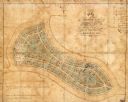
| Description: | This map of Forest Hill Cemetery is ink and watercolor on cloth. The upper right hand margin contains an index by name and lot. The bottom left corner read... |

| Date: | 1928 |
|---|---|
| Description: | This map shows the Forest Hill Cemetery and is oriented with the north to the lower left. The map shows buildings and section numbers but does not include ... |

| Date: | 1800 |
|---|---|
| Description: | This map shows the land claim owned by the Portage Canal Company and includes an index of landownership and landmarks. The Wisconsin and Portage River, the... |

| Date: | 1800 |
|---|---|
| Description: | This map is pencil on tracing paper and shows marshes, the Wisconsin River, Indian trails, and Indian boundary line. The upper left corner reads: "Let sect... |
| Date: | 1941 |
|---|---|
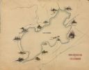
| Description: | This map is ink and watercolor on cardboard and shows Native American legends and villages pictorially. Trails are also shown. |
If you didn't find the material you searched for, our Library Reference Staff can help.
Call our reference desk at 608-264-6535 or email us at: