 Filter: Categories of Wisconsin Historical Images
Filter: Subject of Superior, Lake
Filter: Year of 1900-1999
Filter: Year of 1980-1989
Filter: Categories of Wisconsin Historical Images
Filter: Subject of Superior, Lake
Filter: Year of 1900-1999
Filter: Year of 1980-1989

| Date: | 1981 |
|---|---|
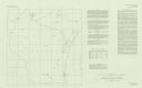
| Description: | Plat map of Madeline Island surrounded by Basswood, Michigan and Gull Islands. |

| Date: | 1988 |
|---|---|
| Description: | Congressman David Obey and his wife Joan on Martin Hanson's pontoon. He was a good friend of the Obeys and was inducted into the Wisconsin Conservation Hal... |
| Date: | 1980 |
|---|---|
| Description: | This map shows earthquake data and includes text about tables, references, and the Modified Mercalli Intensity Scale of 1931. Table one lists earthquakes c... |

| Date: | 1989 |
|---|---|
| Description: | This color coded map shows the various rivers, lakes, bays, and islands that make up the harbor. It includes an index of industries (maritime and non-marit... |
If you didn't find the material you searched for, our Library Reference Staff can help.
Call our reference desk at 608-264-6535 or email us at: