| Date: | 1823 |
|---|---|
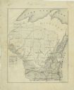
| Description: | In 1823 U.S. Army major Stephen H. Long led an expedition of scientific, trade, and military investigation up the Mississippi River and the Red River of th... |

| Date: | 1814 |
|---|---|
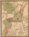
| Description: | Map of the Upper Territories of the United States. |

| Date: | 1884 |
|---|---|
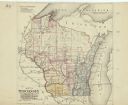
| Description: | The official railroad map of Wisconsin showing railroad lines throughout the state. |

| Date: | 1856 |
|---|---|
| Description: | A map showing rail lines in Wisconsin and the railroad land grants of the Superior & St. Croix Railroad in the present-day northwestern Wisconsin counties ... |

| Date: | 1890 |
|---|---|
| Description: | A map of Wisconsin, eastern Wisconsin and Iowa, northern Illinois, and the Upper Peninsula of Michigan. The counties, cities and villages, and rail lines i... |

| Date: | 1864 |
|---|---|
| Description: | A geological map of Wisconsin that shows the locations of different rock deposits such as limestone, sandstone, shale, plutonic and the Penokee Iron Range.... |

| Date: | 1882 |
|---|---|
| Description: | A geological map of northern Wisconsin showing the locations of different soil types in the state such as sandy soil, sandy loam, prairie loam, clayey loam... |

| Date: | 1874 |
|---|---|
| Description: | A hand-colored, geological map of Wisconsin show the progress of the state geological survey in 1873 and 1874. Other elements displayed in the map include... |

| Date: | 1898 |
|---|---|
| Description: | A hand-colored, cloth mounted map of Wisconsin showing the state’s congressional districts. The map also shows the counties, cities, towns, villages, river... |

| Date: | 1838 |
|---|---|
| Description: | A color map of the settled part of Wisconsin Territory in 1838, including an inset map of the "Entire Territory of Wisconsin as Established by Act of Congr... |

| Date: | 1899 |
|---|---|
| Description: | This map is a folded insert from the pamphlet "Yesterday and Today : A History." The map features the North-Western Line with labeled railway tracks and st... |

| Date: | 1854 |
|---|---|
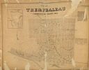
| Description: | This map is mounted on cloth and shows lot and block numbers, streets, additions, and public squares. Also included is information on Trempealeau, an inset... |

| Date: | 1890 |
|---|---|
| Description: | This map shows railroad routes, rivers, and lakes throughout the north central states, primarily North and South Dakota, Minnesota, Wisconsin, Illinois, Io... |

| Date: | 1853 |
|---|---|
| Description: | This facsimile map shows counties, towns, and waterways in the state of Wisconsin. Included are portions of Iowa, Michigan, and Minnesota. Lake Superior an... |

| Date: | 1861 |
|---|---|
| Description: | This map shows railroad and other transportation routes in Wisconsin, northern Illinois, the Upper Peninsula of Michigan, portions of Iowa, Minnesota, and ... |

| Date: | 1854 |
|---|---|
| Description: | A sketch of the public surveys of Wisconsin and territory of Minnesota. |
If you didn't find the material you searched for, our Library Reference Staff can help.
Call our reference desk at 608-264-6535 or email us at: