 Filter: Categories of Wisconsin Historical Images
Filter: Subject of Superior, Lake
Filter: Reproduction Rights of For Sale
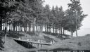
Filter: Subject of camps
Filter: Categories of Wisconsin Historical Images
Filter: Subject of Superior, Lake
Filter: Reproduction Rights of For Sale
Filter: Subject of camps

| Date: | 1925 |
|---|---|
| Description: | This map shows state trunk highways, county trunk highways, railroads, canoe trails, lakes, and free public camp sites. The map on the reverse also shows a... |
| Date: | 1932 |
|---|---|
| Description: | View of two wooden foot bridges in Memorial Park. In the background are the waters of Chequamegon Bay in Lake Superior. Picnic tables are among the trees. ... |

| Date: | 1936 |
|---|---|
| Description: | This 1936 Wisconsin Conservation Dept. map shows the locations of state forestry Civilian Conservation Corps (CCC) camps, closed state forestry CCC camps, ... |

| Date: | 1937 |
|---|---|
| Description: | This Wisconsin Conservation Department map shows the locations of state forests, national forests, county forests, state nurseries, Indian reservations, st... |

| Date: | 1967 |
|---|---|
| Description: | This tourist brochure for Bayfield County, Wisconsin, from 1967 includes a map of the county showing towns, cities and villages, highways and roads, railro... |

| Date: | 1939 |
|---|---|
| Description: | This brochure was intended for tourists and shows resorts, lakes and railroads in northwestern Wisconsin and part of Michigan’s upper peninsula. Also inclu... |
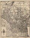
| Date: | 1924 |
|---|---|
| Description: | This map shows roads, cities, rivers,lakes, road surfacings and camp sites. Included are portions of Minnesota, Iowa, Illinois, and Michigan. Includes a le... |

| Date: | 1922 |
|---|---|
| Description: | This map shows in red the NorthWestern Railway Line routes running from Chicago, Illinois to northern Wisconsin. The map includes cities and towns, lakes, ... |

| Date: | 1909 |
|---|---|
| Description: | A hand-drawn and illustrated map of The Gang's trip from their seventh camp to Lake Superior. |
If you didn't find the material you searched for, our Library Reference Staff can help.
Call our reference desk at 608-264-6535 or email us at: