| Date: | 1977 |
|---|---|
| Description: | This pictorial map was produced by the Chateau, a resort in La Pointe, and shows Madeline Island landmarks and tourist attractions. On the verso is the spr... |

| Date: | 1976 |
|---|---|
| Description: | This hand-colored map shows land divided by forest type and tree species. Also shown are counties, Lake Michigan, Lake Superior, Lake Winnebago, and the Mi... |

| Date: | 1975 |
|---|---|
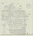
| Description: | This map provides an index of quadrangle maps for the state. The lower left corner contains explanation land surveying completeness. Communities, counties,... |

| Date: | 1975 |
|---|---|
| Description: | This map provides an index of outdated quadrangle maps for the state. Communities, counties, rivers, and lakes are labeled including Lake Michigan and Lake... |

| Date: | 1973 |
|---|---|
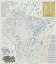
| Description: | This map displays, in color, Wisconsin and bordering areas of Iowa, Minnesota, Illinois, and Michigan. At the bottom is a map key indicating road classifi... |
If you didn't find the material you searched for, our Library Reference Staff can help.
Call our reference desk at 608-264-6535 or email us at: