 Filter: Categories of Wisconsin Historical Images
Filter: Subject of Superior, Lake
Filter: Type of Map or Atlas
Filter: Subject of manufacturing industries
Filter: Categories of Wisconsin Historical Images
Filter: Subject of Superior, Lake
Filter: Type of Map or Atlas
Filter: Subject of manufacturing industries

| Date: | 1883 |
|---|---|
| Description: | Bird's-eye map of Superior, county seat of Douglas County, on the shores of Lake Superior, with insets of points of interest. |

| Date: | 1886 |
|---|---|
| Description: | This map shows lot and block numbers, sold lots, established dock lines, docks, slips, railroads, industrial buildings, streets, and the St. Louis Bay. |

| Date: | 1908 |
|---|---|
| Description: | This map shows streets, industrial buildings, a portion of Lake Superior and other lakes, bays, and rivers in portions of Duluth and Superior. Relief is sh... |

| Date: | 1923 |
|---|---|
| Description: | This map shows the movement of stone to cities along the Great Lakes. Portions of Minnesota, Iowa, Wisconsin, Illinois, Indiana, Ohio, Michigan, New York, ... |
| Date: | 06 01 1900 |
|---|---|
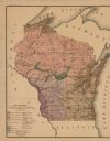
| Description: | This map shows the the locations of different kinds of clay and shales throughout the state of Wisconsin. Includes a colored legend of types of clay and sh... |
If you didn't find the material you searched for, our Library Reference Staff can help.
Call our reference desk at 608-264-6535 or email us at: