Filter: Categories of Wisconsin Historical Images
Filter: Subject of Streets
Filter: Year of 1800-1899
Filter: Creator Name of Sanborn Map Company
Filter: Categories of Wisconsin Historical Images
Filter: Subject of Streets
Filter: Year of 1800-1899
Filter: Creator Name of Sanborn Map Company
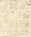
| Date: | 12 1899 |
|---|---|
| Description: | A Sanborn map of Sharon, featuring downtown businesses. |

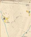
| Date: | 1892 |
|---|---|
| Description: | A Sanborn map of St. Louis, which is six miles southwest of South Superior. |
| Date: | 05 1894 |
|---|---|
| Description: | Sheet 1 of an Onalaska Sanborn map, which includes an index and key. |
| Date: | 05 1894 |
|---|---|
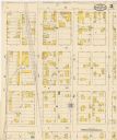
| Description: | Sheet 2 of an Onalaska Sanborn map, including 2nd, 3rd, and 4th Streets. |
| Date: | 05 1894 |
|---|---|
| Description: | Sheet 4 of an Onalaska Sanborn map featuring C.H. Nichols Lumber Company. |
| Date: | 05 1894 |
|---|---|
| Description: | Sheet 5 of an Sanborn map of Onalaska featuring the Island Lumber Company. |

| Date: | 10 1884 |
|---|---|
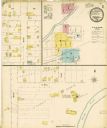
| Description: | A Sanborn map of Watertown, including the City Brewery and the Rock River. |

| Date: | 1884 |
|---|---|
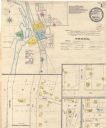
| Description: | Page one of a Sanborn map of River Falls, Wisconsin. |

| Date: | 10 1894 |
|---|---|
| Description: | A Sanborn Fire Insurance Map of Waunakee. |

| Date: | 1892 |
|---|---|
| Description: | A Sanborn fire insurance map of Sauk City which was drawn up in 1892. |

| Date: | 1891 |
|---|---|
| Description: | The index page of a Sanborn Map of Stevens Point. |

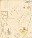
| Date: | 1891 |
|---|---|
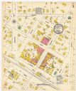
| Description: | Page 13 of a Sanborn map of Stevens Point. |
If you didn't find the material you searched for, our Library Reference Staff can help.
Call our reference desk at 608-264-6535 or email us at: