 Filter: Categories of Wisconsin Historical Images
Filter: Subject of Streams
Filter: Subject of water
Filter: Year of 1900-1999
Filter: Categories of Wisconsin Historical Images
Filter: Subject of Streams
Filter: Subject of water
Filter: Year of 1900-1999

| Date: | 1926 |
|---|---|
| Description: | A map of Lincoln County, Wisconsin that shows the township and range grid, towns, cities and villages, lakes and streams, residences, churches, school hous... |

| Date: | 1923 |
|---|---|
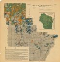
| Description: | A hand-colored map of Marinette County, Wisconsin that shows, townships, towns and plot sections, lakes and streams, cities and villages, and rail lines an... |

| Date: | 1900 |
|---|---|
| Description: | A map of Marinette County, Wisconsin shows the township and range system, sections, towns, cities and villages, streams and lakes, railroads, roads, school... |

| Date: | 09 17 1959 |
|---|---|
| Description: | A map of the Menominee Indian Reservation that shows the highways, different types of roads, rivers and streams in the area. |

| Date: | 1993 |
|---|---|
| Description: | A series of three maps showing the lands of the Menominee, the first of these three maps shows the present-day Menominee Indian Reservation. Highways and r... |

| Date: | 1976 |
|---|---|
| Description: | An 1876 reprinted map of the Township of Franklin, Milwaukee County, Wisconsin, that shows the land ownership and sectioning of the town, as well as the ro... |

| Date: | 1912 |
|---|---|
| Description: | A map of Monroe County, Wisconsin showing townships, the towns of Sparta, Tomah, Oakdale, Wilton, Cashton, Glendale, Kendall and Wyeville, as well as the U... |

| Date: | 1940 |
|---|---|
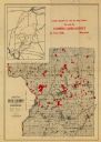
| Description: | This maps shows the areas in Monroe, Jackson, and Juneau counties, Wisconsin, where U.S. Army maneuvers were held in August 1940. Highways and roads, commu... |

| Date: | 1923 |
|---|---|
| Description: | This map from the Wisconsin Lakes and Parks Association shows the area of a proposed state park, much of which is now part of the Flambeau River State Fore... |
| Date: | 1920 |
|---|---|
| Description: | This map shows the township and range system, sections, cities and villages, railroads, roads, and streams and lakes in Oconto County, Wisconsin. Color co... |

| Date: | 1922 |
|---|---|
| Description: | This map from the early to mid-20th century shows the township and range system, towns, cities and villages, roads, railroads, schools, churches, cemeterie... |

| Date: | 1908 |
|---|---|
| Description: | This early 20th century map shows the township and range system, sections, state-owned land, selected buildings and landownership, railroads, bridges, and ... |

| Date: | 1922 |
|---|---|
| Description: | This map from the early to mid-20th century shows the township and range system, towns, cities and villages, roads, railroads, schools, churches, and lakes... |

| Date: | 1908 |
|---|---|
| Description: | This 1908 map shows the township and range grid, sections, towns, villages, railroads, bridges, lakes, streams, rapids, and state-owned lands in Oneida Cou... |

| Date: | 1959 |
|---|---|
| Description: | This map identifies public forest land and industrial forest land as of 1959 in Oneida County, Wisconsin, using a 1930 base map showing the township and ra... |

| Date: | 1903 |
|---|---|
| Description: | This 1903 map of Outagamie County, Wisconsin, shows the township and range grid, towns, sections, cities and villages, landownership and acreages, rural ma... |

| Date: | 1922 |
|---|---|
| Description: | This map of Outagamie County, Wisconsin, from the first half of the 20th century, shows the township and range grid, towns, sections, cities and villages, ... |

| Date: | 1961 |
|---|---|
| Description: | This 1961 map of Ozaukee County, Wisconsin, identifies historic sites and landmarks in the county. Cities and villages, roads, and lakes and streams are al... |

| Date: | 1922 |
|---|---|
| Description: | This map of Pierce County, Wisconsin, from the first half of the 20th century, shows the township and range grid, towns, sections, villages, roads, railroa... |
| Date: | 1900 |
|---|---|
| Description: | This map of Polk County, Wisconsin, from the early 20th century shows the land for sale by the Cushing Land Agency of Saint Croix Falls. The township and r... |
If you didn't find the material you searched for, our Library Reference Staff can help.
Call our reference desk at 608-264-6535 or email us at: